Darvel geodata
Darvel (Scotland) is a populated place; located in United Kingdom in Europe/London (GMT+1) time zone. With population of 3,860 people, there are 1881 cities with bigger population in this country. Compared to other cities in United Kingdom, 89.4% of cities are located further ↓South; 91.4% of cities are located further →East and 74.2% of cities have lower elevation than Darvel. Note1


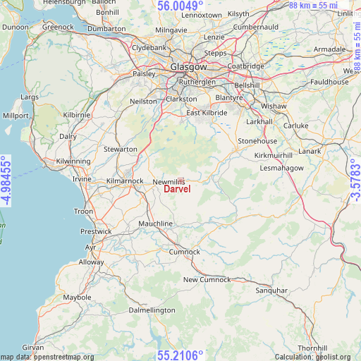
Darvel GPS coordinates[2]
55° 36' 35.136" North, 4° 16' 53.112" West
| Map corner | latitude | longitude |
|---|---|---|
| Upper-left | 56.0049°, | -4.98455° |
| Center: | 55.60976°, | -4.28142° |
| Lower-right: | 55.2106°, | -3.5783° |
| Map W x H: | 88.3×88.3 km | = 54.9×54.9mi |
| max Lat: | 60.39635° ⇑10.6% North |
| Darvel: | 55.60976° |
| min Lat: | ⇓89.4% South 34.60088° |
| min Long | Darvel | max Long |
| -7.64133° | -4.28142° | 32.95536° |
| W 8.6%⇐ | ⇒91.4% E |
Elevation
Elevation of Darvel is 104 m = 341 ft, and this is 31.1 m = 102 ft above average elevation for this country.
| Max E: |
515 m = 1690 ft | 25.8% |
| Darvel | 104 m 341 ft | |
| Avg. | 72.9 m = 239 ft | |
Min E: |
-30 m = -98 ft | 74.2% |
See also: United Kingdom elevation on elevation.city.
Geographical zone
Darvel is located in North temperate zone (between Tropic of Cancer and the Arctic Circle). Distance of this North polar circle is 1217.9 km =756.8 mi to North.| Distance of | km | miles | from Darvel |
|---|---|---|---|
| North Pole | 3823.8 | 2376 | to North |
| Arctic Circle | 1217.9 | 756.8 | to North |
| Tropic Cancer | 3577.3 | 2222.8 | to South |
| Equator | 6183.2 | 3842.1 | to South |


Nearby cities:
15 places around Darvel: (largest is in red/bold)
• Auchinleck
15.4 km =9.6 mi,  182°
182°
• Catrine
12.1 km =7.5 mi,  194°
194°
• Chapelton
16.3 km =10.1 mi,  45°
45°
• Crosshouse
16.9 km =10.5 mi,  271°
271°
• Eaglesham
14.6 km =9.1 mi,  1°
1°
• Fenwick
11.5 km =7.1 mi,  297°
297°
• Galston
6.4 km =4 mi,  261°
261°
• Kilmarnock
13.5 km =8.4 mi, 270°
• Kilmaurs
15.8 km =9.8 mi,  281°
281°
• Mauchline
12.1 km =7.5 mi,  210°
210°
• Muirkirk
16.7 km =10.4 mi,  125°
125°
• Newmilns
2.7 km =1.7 mi, 264°
• Stewarton
16.6 km =10.3 mi, 298°
• Strathaven
15.4 km =9.6 mi,  60°
60°
• Tarbolton
16.8 km =10.4 mi,  230°
230°
Sources, notices
• [Note1] Compared only with cities in United Kingdom existing in our database
• [Src1] Map data: © OpenStreetMap contributors (CC-BY-SA)
• [Src2] Other city data from geonames.org with taken over terms of usage.
• [Src3] Geographical zone / Annual Mean Temperature by Robert A. Rohde @ Wikipedia
