Cwmann geodata
Cwmann (Wales) is a populated place; located in United Kingdom in Europe/London (GMT+1) time zone. With population of 872 people, there are 3877 cities with bigger population in this country. Compared to other cities in United Kingdom, 59.1% of cities are located further ↑North; 88.8% of cities are located further →East and 89.8% of cities have lower elevation than Cwmann. Note1


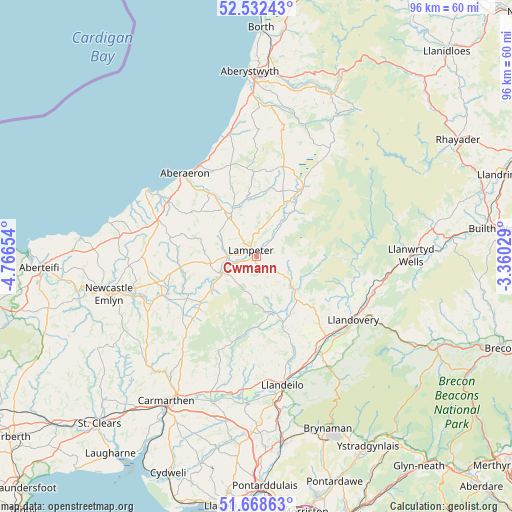
Cwmann GPS coordinates[2]
52° 6' 9.432" North, 4° 3' 48.276" West
| Map corner | latitude | longitude |
|---|---|---|
| Upper-left | 52.53243°, | -4.76654° |
| Center: | 52.10262°, | -4.06341° |
| Lower-right: | 51.66863°, | -3.36029° |
| Map W x H: | 96×96 km | = 59.7×59.7mi |
| max Lat: | 60.39635° ⇑59.1% North |
| Cwmann: | 52.10262° |
| min Lat: | ⇓40.9% South 34.60088° |
| min Long | Cwmann | max Long |
| -7.64133° | -4.06341° | 32.95536° |
| W 11.2%⇐ | ⇒88.8% E |
Elevation
Elevation of Cwmann is 150 m = 492 ft, and this is 77.1 m = 253 ft above average elevation for this country.
| Max E: |
515 m = 1690 ft | 10.2% |
| Cwmann | 150 m 492 ft | |
| Avg. | 72.9 m = 239 ft | |
Min E: |
-30 m = -98 ft | 89.8% |
See also: United Kingdom elevation on elevation.city.
Geographical zone
Cwmann is located in North temperate zone (between Tropic of Cancer and the Arctic Circle). Distance of this North polar circle is 1607.9 km =999.1 mi to North.| Distance of | km | miles | from Cwmann |
|---|---|---|---|
| North Pole | 4213.8 | 2618.3 | to North |
| Arctic Circle | 1607.9 | 999.1 | to North |
| Tropic Cancer | 3187.3 | 1980.5 | to South |
| Equator | 5793.3 | 3599.8 | to South |


Nearby cities:
15 places around Cwmann: (largest is in red/bold)
• Aberaeron
20.5 km =12.7 mi,  319°
319°
• Henfynyw Upper
19.6 km =12.2 mi,  313°
313°
• Lampeter
1.6 km =1 mi, 314°
• Llan-non
21.3 km =13.2 mi,  338°
338°
• Llanarth
19.6 km =12.2 mi,  301°
301°
• Llandovery
21.9 km =13.6 mi,  123°
123°
• Llandysul
18.1 km =11.2 mi,  248°
248°
• Llanfynydd
19.6 km =12.2 mi,  187°
187°
• Llangadog
22.1 km =13.7 mi,  145°
145°
• Llangybi
5.3 km =3.3 mi,  9°
9°
• Llansadwrn
20.3 km =12.6 mi, 146°
• Llansawel
11.8 km =7.3 mi,  164°
164°
• Lledrod
22.6 km =14 mi, 13°
• Pencader
17.9 km =11.1 mi,  230°
230°
• Tregaron
15.8 km =9.8 mi,  34°
34°
Sources, notices
• [Note1] Compared only with cities in United Kingdom existing in our database
• [Src1] Map data: © OpenStreetMap contributors (CC-BY-SA)
• [Src2] Other city data from geonames.org with taken over terms of usage.
• [Src3] Geographical zone / Annual Mean Temperature by Robert A. Rohde @ Wikipedia
