Campbeltown geodata
Campbeltown (Scotland) is a populated place; located in United Kingdom in Europe/London (GMT+1) time zone. With population of 4,800 people, there are 1672 cities with bigger population in this country. Compared to other cities in United Kingdom, 88.4% of cities are located further ↓South; 97.7% of cities are located further →East and 98.4% of cities have higher elevation than Campbeltown. Note1


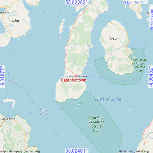
Campbeltown GPS coordinates[2]
55° 25' 32.988" North, 5° 36' 27.504" West
| Map corner | latitude | longitude |
|---|---|---|
| Upper-left | 55.82282°, | -6.31077° |
| Center: | 55.42583°, | -5.60764° |
| Lower-right: | 55.02481°, | -4.90452° |
| Map W x H: | 88.7×88.7 km | = 55.1×55.1mi |
| max Lat: | 60.39635° ⇑11.6% North |
| Campbeltown: | 55.42583° |
| min Lat: | ⇓88.4% South 34.60088° |
| min Long | Campbeltown | max Long |
| -7.64133° | -5.60764° | 32.95536° |
| W 2.3%⇐ | ⇒97.7% E |
Elevation
Elevation of Campbeltown is 5 m = 16 ft, and this is 67.9 m = 223 ft below average elevation for this country.
| Max E: |
515 m = 1690 ft | 98.4% |
| Avg. | 72.9 m = 239 ft | |
| Campbeltown | 5 m = 16 ft | |
Min E: |
-30 m = -98 ft | 1.6% |
See also: United Kingdom elevation on elevation.city.
Geographical zone
Campbeltown is located in North temperate zone (between Tropic of Cancer and the Arctic Circle). Distance of this North polar circle is 1238.4 km =769.5 mi to North.| Distance of | km | miles | from Campbeltown |
|---|---|---|---|
| North Pole | 3844.3 | 2388.7 | to North |
| Arctic Circle | 1238.4 | 769.5 | to North |
| Tropic Cancer | 3556.9 | 2210.2 | to South |
| Equator | 6162.8 | 3829.4 | to South |


Nearby cities:
15 places around Campbeltown: (largest is in red/bold)
• Ballintoy Harbour
52.2 km =32.4 mi,  247°
247°
• Ballycastle
47.1 km =29.3 mi,  238°
238°
• Ballypatrick
43.8 km =27.2 mi,  231°
231°
• Brodick
33.4 km =20.8 mi,  60°
60°
• Carnlough
54 km =33.6 mi,  206°
206°
• Cushendall
48 km =29.8 mi,  216°
216°
• Girvan
51.7 km =32.1 mi,  113°
113°
• Glenariff
50.9 km =31.6 mi, 214°
• Isle of Arran
30.3 km =18.8 mi, 55°
• Lamlash
32.4 km =20.1 mi,  68°
68°
• Maidens
51 km =31.7 mi,  101°
101°
• Port Ellen
43 km =26.7 mi,  302°
302°
• Tarbert
50 km =31.1 mi,  13°
13°
• West Kilbride
55.6 km =34.5 mi, 58°
• Whiting Bay
33 km =20.5 mi,  77°
77°
Sources, notices
• [Note1] Compared only with cities in United Kingdom existing in our database
• [Src1] Map data: © OpenStreetMap contributors (CC-BY-SA)
• [Src2] Other city data from geonames.org with taken over terms of usage.
• [Src3] Geographical zone / Annual Mean Temperature by Robert A. Rohde @ Wikipedia
