Whiting Bay geodata
Whiting Bay (Scotland) is a populated place; located in United Kingdom in Europe/London (GMT+0) time zone. With population of 640 people, there are 4461 cities with bigger population in this country. Compared to other cities in United Kingdom, 88.7% of cities are located further ↓South; 96.6% of cities are located further →East and 67.5% of cities have higher elevation than Whiting Bay. Note1


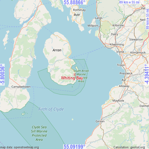
Whiting Bay GPS coordinates[2]
55° 29' 32.424" North, 5° 5' 50.028" West
| Map corner | latitude | longitude |
|---|---|---|
| Upper-left | 55.88866°, | -5.80036° |
| Center: | 55.49234°, | -5.09723° |
| Lower-right: | 55.09199°, | -4.39411° |
| Map W x H: | 88.6×88.6 km | = 55.1×55.1mi |
| max Lat: | 60.39635° ⇑11.3% North |
| Whiting Bay: | 55.49234° |
| min Lat: | ⇓88.7% South 34.60088° |
| min Long | Whiting Bay | max Long |
| -7.64133° | -5.09723° | 32.95536° |
| W 3.4%⇐ | ⇒96.6% E |
Elevation
Elevation of Whiting Bay is 36 m = 118 ft, and this is 36.9 m = 121 ft below average elevation for this country.
| Max E: |
515 m = 1690 ft | 67.5% |
| Avg. | 72.9 m = 239 ft | |
| Whiting Bay | 36 m = 118 ft | |
Min E: |
-30 m = -98 ft | 32.5% |
See also: United Kingdom elevation on elevation.city.
Geographical zone
Whiting Bay is located in North temperate zone (between Tropic of Cancer and the Arctic Circle). Distance of this North polar circle is 1231 km =764.9 mi to North.| Distance of | km | miles | from Whiting Bay |
|---|---|---|---|
| North Pole | 3836.9 | 2384.1 | to North |
| Arctic Circle | 1231 | 764.9 | to North |
| Tropic Cancer | 3564.3 | 2214.8 | to South |
| Equator | 6170.2 | 3834 | to South |


Nearby cities:
15 places around Whiting Bay: (largest is in red/bold)
• Ardrossan
25.3 km =15.7 mi,  46°
46°
• Ayr
29.4 km =18.3 mi,  96°
96°
• Brodick
9.8 km =6.1 mi,  341°
341°
• Isle of Arran
12.3 km =7.6 mi,  323°
323°
• Kilwinning
30.4 km =18.9 mi, 53°
• Lamlash
5 km =3.1 mi, 336°
• Loans
30.5 km =19 mi,  77°
77°
• Maidens
25 km =15.5 mi,  134°
134°
• Maybole
30.4 km =18.9 mi,  120°
120°
• Millport
31 km =19.3 mi,  20°
20°
• Prestwick
30.3 km =18.8 mi,  91°
91°
• Saltcoats
25.3 km =15.7 mi, 50°
• Stevenston
27.1 km =16.8 mi, 52°
• Troon
27.9 km =17.3 mi, 78°
• West Kilbride
26.6 km =16.5 mi,  34°
34°
Sources, notices
• [Note1] Compared only with cities in United Kingdom existing in our database
• [Src1] Map data: © OpenStreetMap contributors (CC-BY-SA)
• [Src2] Other city data from geonames.org with taken over terms of usage.
• [Src3] Geographical zone / Annual Mean Temperature by Robert A. Rohde @ Wikipedia
