Bushmills geodata
Bushmills (Northern Ireland) is a populated place; located in United Kingdom in Europe/London (GMT+0) time zone. With population of 1,309 people, there are 3239 cities with bigger population in this country. Compared to other cities in United Kingdom, 87.8% of cities are located further ↓South; 99.2% of cities are located further →East and 89.9% of cities have higher elevation than Bushmills. Note1


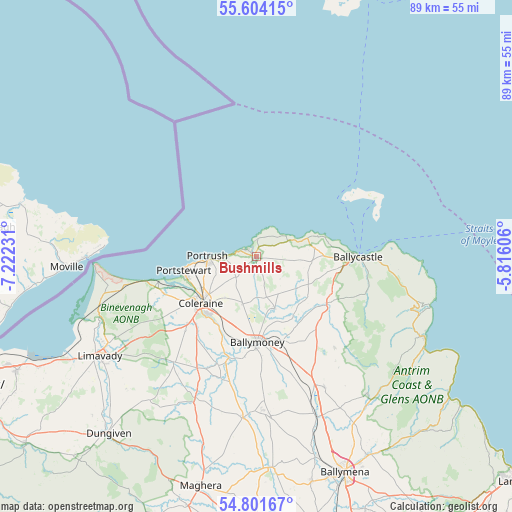
Bushmills GPS coordinates[2]
55° 12' 17.748" North, 6° 31' 9.048" West
| Map corner | latitude | longitude |
|---|---|---|
| Upper-left | 55.60415°, | -7.22231° |
| Center: | 55.20493°, | -6.51918° |
| Lower-right: | 54.80167°, | -5.81606° |
| Map W x H: | 89.2×89.2 km | = 55.4×55.4mi |
| max Lat: | 60.39635° ⇑12.2% North |
| Bushmills: | 55.20493° |
| min Lat: | ⇓87.8% South 34.60088° |
| min Long | Bushmills | max Long |
| -7.64133° | -6.51918° | 32.95536° |
| W 0.8%⇐ | ⇒99.2% E |
Elevation
Elevation of Bushmills is 12 m = 39 ft, and this is 60.9 m = 200 ft below average elevation for this country.
| Max E: |
515 m = 1690 ft | 89.9% |
| Avg. | 72.9 m = 239 ft | |
| Bushmills | 12 m = 39 ft | |
Min E: |
-30 m = -98 ft | 10.1% |
See also: United Kingdom elevation on elevation.city.
Geographical zone
Bushmills is located in North temperate zone (between Tropic of Cancer and the Arctic Circle). Distance of this North polar circle is 1263 km =784.8 mi to North.| Distance of | km | miles | from Bushmills |
|---|---|---|---|
| North Pole | 3868.8 | 2404 | to North |
| Arctic Circle | 1263 | 784.8 | to North |
| Tropic Cancer | 3532.3 | 2194.9 | to South |
| Equator | 6138.2 | 3814.1 | to South |


Nearby cities:
15 places around Bushmills: (largest is in red/bold)
• Ballintoy Harbour
10.5 km =6.5 mi,  65°
65°
• Ballycastle
17.5 km =10.9 mi,  90°
90°
• Ballykelly
36.4 km =22.6 mi,  240°
240°
• Ballymoney
14.9 km =9.3 mi,  177°
177°
• Ballypatrick
23.6 km =14.7 mi,  96°
96°
• Castlerock
17.8 km =11.1 mi,  249°
249°
• Coleraine
12.3 km =7.6 mi,  229°
229°
• Cushendall
32.1 km =19.9 mi,  115°
115°
• Dunloy
22.6 km =14 mi,  162°
162°
• Garvagh
26.4 km =16.4 mi,  200°
200°
• Glenariff
33.5 km =20.8 mi, 120°
• Kilrea
28.3 km =17.6 mi, 184°
• Limavady
32.4 km =20.1 mi, 237°
• Portrush
8.3 km =5.2 mi,  263°
263°
• Portstewart
12.6 km =7.8 mi, 258°
Sources, notices
• [Note1] Compared only with cities in United Kingdom existing in our database
• [Src1] Map data: © OpenStreetMap contributors (CC-BY-SA)
• [Src2] Other city data from geonames.org with taken over terms of usage.
• [Src3] Geographical zone / Annual Mean Temperature by Robert A. Rohde @ Wikipedia
