Burniston geodata
Burniston (England) is a populated place; located in United Kingdom in Europe/London (GMT+0) time zone. With population of 1,523 people, there are 3025 cities with bigger population in this country. Compared to other cities in United Kingdom, 80.8% of cities are located further ↓South; 78% of cities are located further ←West and 54.4% of cities have higher elevation than Burniston. Note1
Administrative division(s):
- Level 1: England
- Level 2: North Yorkshire
- Level 3: Scarborough District
- Level 4: Burniston


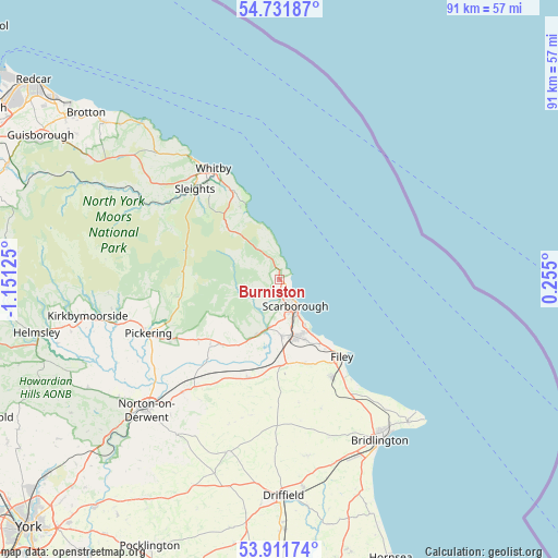
Burniston GPS coordinates[2]
54° 19' 25.86" North, 0° 26' 53.268" West
| Map corner | latitude | longitude |
|---|---|---|
| Upper-left | 54.73187°, | -1.15125° |
| Center: | 54.32385°, | -0.44813° |
| Lower-right: | 53.91174°, | 0.255° |
| Map W x H: | 91.2×91.2 km | = 56.7×56.7mi |
| max Lat: | 60.39635° ⇑19.2% North |
| Burniston: | 54.32385° |
| min Lat: | ⇓80.8% South 34.60088° |
| min Long | Burniston | max Long |
| -7.64133° | -0.44813° | 32.95536° |
| W 78%⇐ | ⇒22% E |
Elevation
Elevation of Burniston is 54 m = 177 ft, and this is 18.9 m = 62 ft below average elevation for this country.
| Max E: |
515 m = 1690 ft | 54.4% |
| Avg. | 72.9 m = 239 ft | |
| Burniston | 54 m = 177 ft | |
Min E: |
-30 m = -98 ft | 45.6% |
See also: United Kingdom elevation on elevation.city.
Geographical zone
Burniston is located in North temperate zone (between Tropic of Cancer and the Arctic Circle). Distance of this North polar circle is 1360.9 km =845.6 mi to North.| Distance of | km | miles | from Burniston |
|---|---|---|---|
| North Pole | 3966.8 | 2464.9 | to North |
| Arctic Circle | 1360.9 | 845.6 | to North |
| Tropic Cancer | 3434.3 | 2134 | to South |
| Equator | 6040.2 | 3753.2 | to South |


Nearby cities:
15 places around Burniston: (largest is in red/bold)
• Cloughton
1.6 km =1 mi,  358°
358°
• East Ayton
7.9 km =4.9 mi,  192°
192°
• Filey
16.3 km =10.1 mi,  140°
140°
• Hunmanby
18.1 km =11.2 mi,  152°
152°
• Marishes
23.7 km =14.7 mi,  235°
235°
• Pickering
22.2 km =13.8 mi,  248°
248°
• Rillington
24.5 km =15.2 mi,  220°
220°
• Scarborough
5.7 km =3.5 mi, 150°
• Sleights
20.2 km =12.6 mi,  316°
316°
• Snainton
14 km =8.7 mi, 220°
• Thornton Dale
20.2 km =12.6 mi, 240°
• Thwing
23.5 km =14.6 mi,  170°
170°
• Whitby
21.2 km =13.2 mi,  329°
329°
• Wintringham
23.7 km =14.7 mi,  213°
213°
• Wold Newton
20.4 km =12.7 mi, 171°
Sources, notices
• [Note1] Compared only with cities in United Kingdom existing in our database
• [Src1] Map data: © OpenStreetMap contributors (CC-BY-SA)
• [Src2] Other city data from geonames.org with taken over terms of usage.
• [Src3] Geographical zone / Annual Mean Temperature by Robert A. Rohde @ Wikipedia
