Bexley geodata
Bexley (England) is a populated locality; located in United Kingdom in Europe/London (GMT+1) time zone. With population of 228,000 people, there are 34 cities with bigger population in this country. Compared to other cities in United Kingdom, 79.7% of cities are located further ↑North; 88.4% of cities are located further ←West and 84.7% of cities have higher elevation than Bexley. Note1


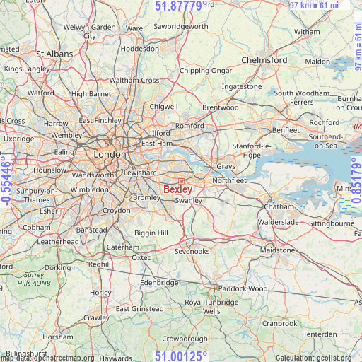
Bexley GPS coordinates[2]
51° 26' 29.832" North, 0° 8' 55.176" East
| Map corner | latitude | longitude |
|---|---|---|
| Upper-left | 51.87779°, | -0.55446° |
| Center: | 51.44162°, | 0.14866° |
| Lower-right: | 51.00125°, | 0.85179° |
| Map W x H: | 97.5×97.5 km | = 60.6×60.6mi |
| max Lat: | 60.39635° ⇑79.7% North |
| Bexley: | 51.44162° |
| min Lat: | ⇓20.3% South 34.60088° |
| min Long | Bexley | max Long |
| -7.64133° | 0.14866° | 32.95536° |
| W 88.4%⇐ | ⇒11.6% E |
Elevation
Elevation of Bexley is 16 m = 52 ft, and this is 56.9 m = 187 ft below average elevation for this country.
| Max E: |
515 m = 1690 ft | 84.7% |
| Avg. | 72.9 m = 239 ft | |
| Bexley | 16 m = 52 ft | |
Min E: |
-30 m = -98 ft | 15.3% |
See also: Bexley elevation on elevation.city.
Geographical zone
Bexley is located in North temperate zone (between Tropic of Cancer and the Arctic Circle). Distance of this North polar circle is 1681.4 km =1044.8 mi to North.| Distance of | km | miles | from Bexley |
|---|---|---|---|
| North Pole | 4287.3 | 2664 | to North |
| Arctic Circle | 1681.4 | 1044.8 | to North |
| Tropic Cancer | 3113.9 | 1934.9 | to South |
| Equator | 5719.8 | 3554.1 | to South |


Nearby cities:
15 places around Bexley: (largest is in red/bold)
• Abbey Wood
5.8 km =3.6 mi,  330°
330°
• Belvedere
5.5 km =3.4 mi,  1°
1°
• Bexleyheath
2.5 km =1.6 mi,  344°
344°
• Chislehurst
6.2 km =3.9 mi,  243°
243°
• Darenth
7.9 km =4.9 mi,  106°
106°
• Dartford
4.6 km =2.9 mi,  83°
83°
• Erith
5 km =3.1 mi,  21°
21°
• Horton Kirby
8.5 km =5.3 mi,  127°
127°
• Orpington
8.2 km =5.1 mi,  205°
205°
• Purfleet
8 km =5 mi,  54°
54°
• Sidcup
3.6 km =2.2 mi, 241°
• Stone
8.1 km =5 mi, 83°
• Swanley
5.2 km =3.2 mi,  160°
160°
• Welling
3.7 km =2.3 mi,  309°
309°
• Woolwich
8 km =5 mi, 313°
Sources, notices
• [Note1] Compared only with cities in United Kingdom existing in our database
• [Src1] Map data: © OpenStreetMap contributors (CC-BY-SA)
• [Src2] Other city data from geonames.org with taken over terms of usage.
• [Src3] Geographical zone / Annual Mean Temperature by Robert A. Rohde @ Wikipedia
