Andover geodata
Andover (England) is a populated place; located in United Kingdom in Europe/London (GMT+1) time zone. With population of 42,276 people, there are 285 cities with bigger population in this country. Compared to other cities in United Kingdom, 86.5% of cities are located further ↑North; 55.6% of cities are located further ←West and 56.6% of cities have lower elevation than Andover. Note1
Administrative division(s):
- Level 1: England
- Level 2: Hampshire
- Level 3: Test Valley District
- Level 4: Andover


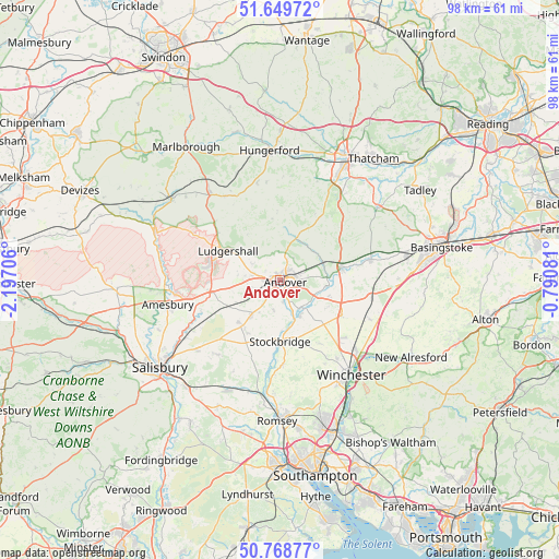
Andover GPS coordinates[2]
51° 12' 40.86" North, 1° 29' 38.148" West
| Map corner | latitude | longitude |
|---|---|---|
| Upper-left | 51.64972°, | -2.19706° |
| Center: | 51.21135°, | -1.49393° |
| Lower-right: | 50.76877°, | -0.79081° |
| Map W x H: | 98×98 km | = 60.9×60.9mi |
| max Lat: | 60.39635° ⇑86.5% North |
| Andover: | 51.21135° |
| min Lat: | ⇓13.5% South 34.60088° |
| min Long | Andover | max Long |
| -7.64133° | -1.49393° | 32.95536° |
| W 55.6%⇐ | ⇒44.4% E |
Elevation
Elevation of Andover is 71 m = 233 ft, and this is 1.9 m = 6 ft below average elevation for this country.
| Max E: |
515 m = 1690 ft | 43.4% |
| Avg. | 72.9 m = 239 ft | |
| Andover | 71 m = 233 ft | |
Min E: |
-30 m = -98 ft | 56.6% |
See also: Andover elevation on elevation.city.
Geographical zone
Andover is located in North temperate zone (between Tropic of Cancer and the Arctic Circle). Distance of this North polar circle is 1707 km =1060.7 mi to North.| Distance of | km | miles | from Andover |
|---|---|---|---|
| North Pole | 4312.9 | 2679.9 | to North |
| Arctic Circle | 1707 | 1060.7 | to North |
| Tropic Cancer | 3088.2 | 1918.9 | to South |
| Equator | 5694.2 | 3538.2 | to South |


Nearby cities:
15 places around Andover: (largest is in red/bold)
• Abbotts Ann
3.6 km =2.2 mi,  228°
228°
• Anna Valley
2.2 km =1.4 mi,  204°
204°
• Appleshaw
5.7 km =3.5 mi,  300°
300°
• Barton Stacey
9.5 km =5.9 mi,  121°
121°
• Chilbolton
7 km =4.3 mi,  145°
145°
• Goodworth Clatford
3.7 km =2.3 mi,  168°
168°
• Hurstbourne Tarrant
7.8 km =4.8 mi,  21°
21°
• Ludgershall
10.2 km =6.3 mi, 298°
• Monxton
4.4 km =2.7 mi,  249°
249°
• Over Wallop
10.1 km =6.3 mi,  224°
224°
• St Mary Bourne
7.9 km =4.9 mi,  52°
52°
• Stockbridge
10.8 km =6.7 mi,  177°
177°
• Tidworth
12 km =7.5 mi,  280°
280°
• Vernham Dean
10.7 km =6.6 mi,  353°
353°
• Weyhill
4 km =2.5 mi, 282°
Sources, notices
• [Note1] Compared only with cities in United Kingdom existing in our database
• [Src1] Map data: © OpenStreetMap contributors (CC-BY-SA)
• [Src2] Other city data from geonames.org with taken over terms of usage.
• [Src3] Geographical zone / Annual Mean Temperature by Robert A. Rohde @ Wikipedia
