Weyhill geodata
Weyhill (England) is a populated place; located in United Kingdom in Europe/London (GMT+1) time zone. With population of 630 people, there are 4492 cities with bigger population in this country. Compared to other cities in United Kingdom, 86.4% of cities are located further ↑North; 54.3% of cities are located further ←West and 69.3% of cities have lower elevation than Weyhill. Note1
Administrative division(s):
- Level 1: England
- Level 2: Hampshire
- Level 3: Test Valley District
- Level 4: Penton Grafton


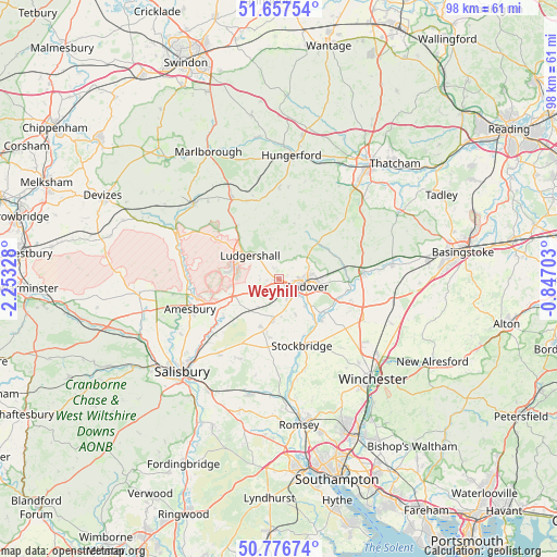
Weyhill GPS coordinates[2]
51° 13' 9.3" North, 1° 33' 0.54" West
| Map corner | latitude | longitude |
|---|---|---|
| Upper-left | 51.65754°, | -2.25328° |
| Center: | 51.21925°, | -1.55015° |
| Lower-right: | 50.77674°, | -0.84703° |
| Map W x H: | 97.9×97.9 km | = 60.8×60.8mi |
| max Lat: | 60.39635° ⇑86.4% North |
| Weyhill: | 51.21925° |
| min Lat: | ⇓13.6% South 34.60088° |
| min Long | Weyhill | max Long |
| -7.64133° | -1.55015° | 32.95536° |
| W 54.3%⇐ | ⇒45.7% E |
Elevation
Elevation of Weyhill is 94 m = 308 ft, and this is 21.1 m = 69 ft above average elevation for this country.
| Max E: |
515 m = 1690 ft | 30.7% |
| Weyhill | 94 m 308 ft | |
| Avg. | 72.9 m = 239 ft | |
Min E: |
-30 m = -98 ft | 69.3% |
See also: United Kingdom elevation on elevation.city.
Geographical zone
Weyhill is located in North temperate zone (between Tropic of Cancer and the Arctic Circle). Distance of this North polar circle is 1706.1 km =1060.1 mi to North.| Distance of | km | miles | from Weyhill |
|---|---|---|---|
| North Pole | 4312 | 2679.4 | to North |
| Arctic Circle | 1706.1 | 1060.1 | to North |
| Tropic Cancer | 3089.1 | 1919.5 | to South |
| Equator | 5695 | 3538.7 | to South |


Nearby cities:
15 places around Weyhill: (largest is in red/bold)
• Abbotts Ann
3.5 km =2.2 mi,  159°
159°
• Andover
4 km =2.5 mi,  102°
102°
• Anna Valley
4.2 km =2.6 mi,  134°
134°
• Appleshaw
2.3 km =1.4 mi,  332°
332°
• Chilbolton
10.4 km =6.5 mi, 130°
• Collingbourne Ducis
10.2 km =6.3 mi,  315°
315°
• Collingbourne Kingston
11.8 km =7.3 mi, 320°
• Goodworth Clatford
6.5 km =4 mi, 134°
• Hurstbourne Tarrant
9.3 km =5.8 mi,  46°
46°
• Ludgershall
6.4 km =4 mi,  308°
308°
• Monxton
2.4 km =1.5 mi,  184°
184°
• Over Wallop
8.7 km =5.4 mi,  200°
200°
• St Mary Bourne
10.9 km =6.8 mi,  69°
69°
• Tidworth
8 km =5 mi,  279°
279°
• Vernham Dean
10.1 km =6.3 mi,  15°
15°
Sources, notices
• [Note1] Compared only with cities in United Kingdom existing in our database
• [Src1] Map data: © OpenStreetMap contributors (CC-BY-SA)
• [Src2] Other city data from geonames.org with taken over terms of usage.
• [Src3] Geographical zone / Annual Mean Temperature by Robert A. Rohde @ Wikipedia
