Aberchirder geodata
Aberchirder (Scotland) is a populated place; located in United Kingdom in Europe/London (GMT+1) time zone. With population of 1,250 people, there are 3296 cities with bigger population in this country. Compared to other cities in United Kingdom, 98.8% of cities are located further ↓South; 67.4% of cities are located further →East and 88.3% of cities have lower elevation than Aberchirder. Note1


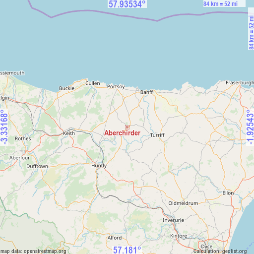
Aberchirder GPS coordinates[2]
57° 33' 36.432" North, 2° 37' 42.816" West
| Map corner | latitude | longitude |
|---|---|---|
| Upper-left | 57.93534°, | -3.33168° |
| Center: | 57.56012°, | -2.62856° |
| Lower-right: | 57.181°, | -1.92543° |
| Map W x H: | 83.9×83.9 km | = 52.1×52.1mi |
| max Lat: | 60.39635° ⇑1.2% North |
| Aberchirder: | 57.56012° |
| min Lat: | ⇓98.8% South 34.60088° |
| min Long | Aberchirder | max Long |
| -7.64133° | -2.62856° | 32.95536° |
| W 32.6%⇐ | ⇒67.4% E |
Elevation
Elevation of Aberchirder is 144 m = 472 ft, and this is 71.1 m = 233 ft above average elevation for this country.
| Max E: |
515 m = 1690 ft | 11.7% |
| Aberchirder | 144 m 472 ft | |
| Avg. | 72.9 m = 239 ft | |
Min E: |
-30 m = -98 ft | 88.3% |
See also: United Kingdom elevation on elevation.city.
Geographical zone
Aberchirder is located in North temperate zone (between Tropic of Cancer and the Arctic Circle). Distance of this North polar circle is 1001.1 km =622.1 mi to North.| Distance of | km | miles | from Aberchirder |
|---|---|---|---|
| North Pole | 3607 | 2241.3 | to North |
| Arctic Circle | 1001.1 | 622.1 | to North |
| Tropic Cancer | 3794.2 | 2357.6 | to South |
| Equator | 6400.1 | 3976.8 | to South |


Nearby cities:
15 places around Aberchirder: (largest is in red/bold)
• Banff
13 km =8.1 mi,  26°
26°
• Bridgend
21.1 km =13.1 mi,  212°
212°
• Buckie
23.7 km =14.7 mi,  302°
302°
• Cullen
18.4 km =11.4 mi,  322°
322°
• Cuminestown
17.6 km =10.9 mi,  96°
96°
• Findochty
22.3 km =13.9 mi,  313°
313°
• Gardenstown
21.3 km =13.2 mi,  54°
54°
• Huntly
15.7 km =9.8 mi,  216°
216°
• Keith
19.2 km =11.9 mi,  262°
262°
• Macduff
14.5 km =9 mi, 32°
• Portknockie
21 km =13 mi, 318°
• Portsoy
14 km =8.7 mi,  344°
344°
• Rothienorman
19.2 km =11.9 mi,  149°
149°
• Turriff
10.4 km =6.5 mi, 103°
• Whitehills
13.4 km =8.3 mi,  12°
12°
Sources, notices
• [Note1] Compared only with cities in United Kingdom existing in our database
• [Src1] Map data: © OpenStreetMap contributors (CC-BY-SA)
• [Src2] Other city data from geonames.org with taken over terms of usage.
• [Src3] Geographical zone / Annual Mean Temperature by Robert A. Rohde @ Wikipedia
