Heol-y-Cyw geodata
Heol-y-Cyw (Wales) is a populated place; located in United Kingdom in Europe/London (GMT+1) time zone. With population of 538 people, there are 4774 cities with bigger population in this country. Compared to other cities in United Kingdom, 76.2% of cities are located further ↑North; 82.6% of cities are located further →East and 70.3% of cities have lower elevation than Heol-y-Cyw. Note1
Administrative division(s):
- Level 1: Wales
- Level 2: Bridgend county borough
- Level 3: Coychurch Higher


Heol-y-Cyw GPS coordinates[2]
51° 32' 50.748" North, 3° 31' 20.748" West
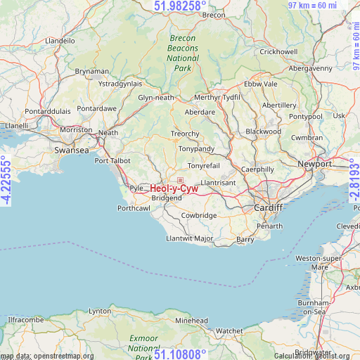
| Map corner | latitude | longitude |
|---|---|---|
| Upper-left | 51.98258°, | -4.22555° |
| Center: | 51.54743°, | -3.52243° |
| Lower-right: | 51.10808°, | -2.8193° |
| Map W x H: | 97.2×97.2 km | = 60.4×60.4mi |
| max Lat: | 60.39635° ⇑76.2% North |
| Heol-y-Cyw: | 51.54743° |
| min Lat: | ⇓23.8% South 34.60088° |
| min Long | Heol-y-Cyw | max Long |
| -7.64133° | -3.52243° | 32.95536° |
| W 17.4%⇐ | ⇒82.6% E |
Elevation
Elevation of Heol-y-Cyw is 96 m = 315 ft, and this is 23.1 m = 76 ft above average elevation for this country.
| Max E: |
515 m = 1690 ft | 29.7% |
| Heol-y-Cyw | 96 m 315 ft | |
| Avg. | 72.9 m = 239 ft | |
Min E: |
-30 m = -98 ft | 70.3% |
See also: United Kingdom elevation on elevation.city.
Geographical zone
Heol-y-Cyw is located in North temperate zone (between Tropic of Cancer and the Arctic Circle). Distance of this North polar circle is 1669.6 km =1037.4 mi to North.| Distance of | km | miles | from Heol-y-Cyw |
|---|---|---|---|
| North Pole | 4275.5 | 2656.7 | to North |
| Arctic Circle | 1669.6 | 1037.4 | to North |
| Tropic Cancer | 3125.6 | 1942.2 | to South |
| Equator | 5731.5 | 3561.4 | to South |


Nearby cities:
15 places around Heol-y-Cyw: (largest is in red/bold)
• Aberkenfig
5.1 km =3.2 mi,  260°
260°
• Betws
5.2 km =3.2 mi,  297°
297°
• Blackmill
2.6 km =1.6 mi,  333°
333°
• Bridgend
6 km =3.7 mi,  219°
219°
• Brynna
4.2 km =2.6 mi,  103°
103°
• Coity
3.6 km =2.2 mi, 218°
• Gilfach Goch
6 km =3.7 mi,  34°
34°
• Llangan
6.9 km =4.3 mi,  167°
167°
• Llangeinor
4.5 km =2.8 mi,  314°
314°
• Llanharan
5.9 km =3.7 mi, 100°
• Llanharry
7.2 km =4.5 mi,  120°
120°
• Ogmore Vale
6.3 km =3.9 mi,  347°
347°
• Pencoed
3.1 km =1.9 mi,  149°
149°
• Price Town
7.9 km =4.9 mi, 352°
• Tonyrefail
7.6 km =4.7 mi,  57°
57°
Sources, notices
• [Note1] Compared only with cities in United Kingdom existing in our database
• [Src1] Map data: © OpenStreetMap contributors (CC-BY-SA)
• [Src2] Other city data from geonames.org with taken over terms of usage.
• [Src3] Geographical zone / Annual Mean Temperature by Robert A. Rohde @ Wikipedia
