Cotheridge geodata
Cotheridge (England) is a seat of a fourth-order administrative division; located in United Kingdom in Europe/London (GMT+1) time zone. In our database, there are 4977 cities with bigger population. Compared to other cities in United Kingdom, 56.7% of cities are located further ↑North; 61.5% of cities are located further →East and 67.5% of cities have higher elevation than Cotheridge. Note1
Administrative division(s):
- Level 1: England
- Level 2: Worcestershire
- Level 3: Malvern Hills District
- Level 4: Cotheridge


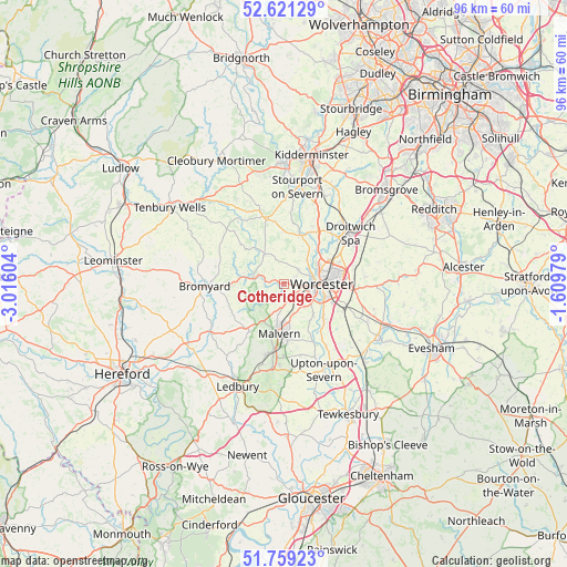
Cotheridge GPS coordinates[2]
52° 11' 32.46" North, 2° 18' 46.512" West
| Map corner | latitude | longitude |
|---|---|---|
| Upper-left | 52.62129°, | -3.01604° |
| Center: | 52.19235°, | -2.31292° |
| Lower-right: | 51.75923°, | -1.60979° |
| Map W x H: | 95.9×95.8 km | = 59.6×59.5mi |
| max Lat: | 60.39635° ⇑56.7% North |
| Cotheridge: | 52.19235° |
| min Lat: | ⇓43.3% South 34.60088° |
| min Long | Cotheridge | max Long |
| -7.64133° | -2.31292° | 32.95536° |
| W 38.5%⇐ | ⇒61.5% E |
Elevation
Elevation of Cotheridge is 36 m = 118 ft, and this is 36.9 m = 121 ft below average elevation for this country.
| Max E: |
515 m = 1690 ft | 67.5% |
| Avg. | 72.9 m = 239 ft | |
| Cotheridge | 36 m = 118 ft | |
Min E: |
-30 m = -98 ft | 32.5% |
See also: United Kingdom elevation on elevation.city.
Geographical zone
Cotheridge is located in North temperate zone (between Tropic of Cancer and the Arctic Circle). Distance of this North polar circle is 1597.9 km =992.9 mi to North.| Distance of | km | miles | from Cotheridge |
|---|---|---|---|
| North Pole | 4203.8 | 2612.1 | to North |
| Arctic Circle | 1597.9 | 992.9 | to North |
| Tropic Cancer | 3197.3 | 1986.7 | to South |
| Equator | 5803.2 | 3605.9 | to South |


Nearby cities:
15 places around Cotheridge: (largest is in red/bold)
• Bransford
2.4 km =1.5 mi,  160°
160°
• Bromyard
13.4 km =8.3 mi,  268°
268°
• Clifton upon Teme
9.9 km =6.2 mi,  311°
311°
• Droitwich
13.8 km =8.6 mi,  53°
53°
• Evesbatch
11.4 km =7.1 mi,  234°
234°
• Fernhill Heath
9 km =5.6 mi,  62°
62°
• Great Malvern
9 km =5.6 mi,  185°
185°
• Great Witley
11.8 km =7.3 mi,  342°
342°
• Hallow
5.3 km =3.3 mi, 48°
• Hanley Swan
12.4 km =7.7 mi,  167°
167°
• Kempsey
8.8 km =5.5 mi,  132°
132°
• Leigh
1.7 km =1.1 mi, 187°
• Lower Broadheath
3.4 km =2.1 mi, 45°
• Ombersley
10.5 km =6.5 mi,  33°
33°
• Worcester
6.3 km =3.9 mi,  93°
93°
Sources, notices
• [Note1] Compared only with cities in United Kingdom existing in our database
• [Src1] Map data: © OpenStreetMap contributors (CC-BY-SA)
• [Src2] Other city data from geonames.org with taken over terms of usage.
• [Src3] Geographical zone / Annual Mean Temperature by Robert A. Rohde @ Wikipedia
