Denton Holme geodata
Denton Holme (England) is a section of populated place; located in United Kingdom in Europe/London (GMT+1) time zone. With population of 6,500 people, there are 1389 cities with bigger population in this country. Compared to other cities in United Kingdom, 85.7% of cities are located further ↓South; 74% of cities are located further →East and 82.8% of cities have higher elevation than Denton Holme. Note1


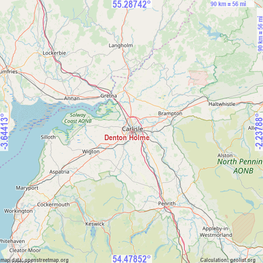
Denton Holme GPS coordinates[2]
54° 53' 6" North, 2° 56' 27.6" West
| Map corner | latitude | longitude |
|---|---|---|
| Upper-left | 55.28742°, | -3.64413° |
| Center: | 54.885°, | -2.941° |
| Lower-right: | 54.47852°, | -2.23788° |
| Map W x H: | 89.9×89.9 km | = 55.9×55.9mi |
| max Lat: | 60.39635° ⇑14.3% North |
| Denton Holme: | 54.885° |
| min Lat: | ⇓85.7% South 34.60088° |
| min Long | Denton Holme | max Long |
| -7.64133° | -2.941° | 32.95536° |
| W 26%⇐ | ⇒74% E |
Elevation
Elevation of Denton Holme is 18 m = 59 ft, and this is 54.9 m = 180 ft below average elevation for this country.
| Max E: |
515 m = 1690 ft | 82.8% |
| Avg. | 72.9 m = 239 ft | |
| Denton Holme | 18 m = 59 ft | |
Min E: |
-30 m = -98 ft | 17.2% |
See also: United Kingdom elevation on elevation.city.
Geographical zone
Denton Holme is located in North temperate zone (between Tropic of Cancer and the Arctic Circle). Distance of this North polar circle is 1298.5 km =806.9 mi to North.| Distance of | km | miles | from Denton Holme |
|---|---|---|---|
| North Pole | 3904.4 | 2426.1 | to North |
| Arctic Circle | 1298.5 | 806.9 | to North |
| Tropic Cancer | 3496.7 | 2172.7 | to South |
| Equator | 6102.6 | 3792 | to South |


Nearby cities:
15 places around Denton Holme: (largest is in red/bold)
• Annan
23.2 km =14.4 mi,  299°
299°
• Brampton
15.1 km =9.4 mi,  61°
61°
• Burgh by Sands
8.5 km =5.3 mi, 298°
• Carlisle
1.1 km =0.7 mi,  9°
9°
• Dalston
5.5 km =3.4 mi,  210°
210°
• Eaglesfield
25.3 km =15.7 mi,  319°
319°
• Eastriggs
19 km =11.8 mi,  306°
306°
• Gretna
14.5 km =9 mi,  326°
326°
• Greystoke
24.4 km =15.2 mi,  169°
169°
• Lazonby
21.6 km =13.4 mi,  135°
135°
• Longtown
13.9 km =8.6 mi,  353°
353°
• Scotby
4.3 km =2.7 mi,  82°
82°
• Thursby
8.5 km =5.3 mi,  236°
236°
• Wetheral
6.9 km =4.3 mi,  90°
90°
• Wigton
15.6 km =9.7 mi, 244°
Sources, notices
• [Note1] Compared only with cities in United Kingdom existing in our database
• [Src1] Map data: © OpenStreetMap contributors (CC-BY-SA)
• [Src2] Other city data from geonames.org with taken over terms of usage.
• [Src3] Geographical zone / Annual Mean Temperature by Robert A. Rohde @ Wikipedia
