Naghvarevi geodata
Naghvarevi (Kvemo Kartli) is a populated place; located in Georgia in Asia/Tbilisi (GMT+4) time zone. With population of 5,238 people, there are 54 cities with bigger population in this country. Compared to other cities in Georgia, 98.3% of cities are located further ↑North; 85.5% of cities are located further ←West and 50.4% of cities have higher elevation than Naghvarevi. Note1


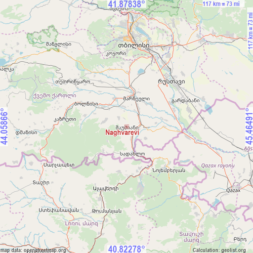
Naghvarevi GPS coordinates[2]
41° 21' 9.792" North, 44° 45' 42.408" East
| Map corner | latitude | longitude |
|---|---|---|
| Upper-left | 41.87838°, | 44.05866° |
| Center: | 41.35272°, | 44.76178° |
| Lower-right: | 40.82278°, | 45.46491° |
| Map W x H: | 117.4×117.4 km | = 72.9×72.9mi |
| max Lat: | 43.38111° ⇑98.3% North |
| Naghvarevi: | 41.35272° |
| min Lat: | ⇓1.7% South 41.21725° |
| min Long | Naghvarevi | max Long |
| 40.07944° | 44.76178° | 46.27667° |
| W 85.5%⇐ | ⇒14.5% E |
Elevation
Elevation of Naghvarevi is 493 m = 1617 ft, and this is 85.8 m = 281 ft below average elevation for this country.
| Max E: |
2223 m = 7293 ft | 50.4% |
| Avg. | 578.8 m = 1899 ft | |
| Naghvarevi | 493 m = 1617 ft | |
Min E: |
1 m = 3 ft | 49.6% |
See also: Georgia elevation on elevation.city.
Geographical zone
Naghvarevi is located in North temperate zone (between Tropic of Cancer and the Arctic Circle). Distance of this Northern Tropic circle is 1992.1 km =1237.8 mi to South.| Distance of | km | miles | from Naghvarevi |
|---|---|---|---|
| North Pole | 5409.1 | 3361.1 | to North |
| Arctic Circle | 2803.2 | 1741.8 | to North |
| Tropic Cancer | 1992.1 | 1237.8 | to South |
| Equator | 4598 | 2857.1 | to South |


Nearby cities:
15 places around Naghvarevi: (largest is in red/bold)
• Bolnisi
21.4 km =13.3 mi,  299°
299°
• Didi Lilo
45.9 km =28.5 mi,  21°
21°
• Dmanisi
39.5 km =24.5 mi, 299°
• Dzegvi
56.4 km =35 mi,  346°
346°
• Gardabani
30.1 km =18.7 mi,  66°
66°
• Kojori
34.4 km =21.4 mi, 351°
• Manglisi
49.5 km =30.8 mi,  320°
320°
• Marneuli
14.2 km =8.8 mi, 16°
• Mtskheta
54.9 km =34.1 mi,  356°
356°
• Rust’avi
29.2 km =18.1 mi,  41°
41°
• Tbilisi
38.4 km =23.9 mi,  8°
8°
• Tsalka
62.2 km =38.6 mi, 295°
• Tsqnet’i
38.4 km =23.9 mi, 352°
• T’et’ri Tsqaro
32.9 km =20.4 mi,  310°
310°
• Zahesi
52.5 km =32.6 mi, 359°
Sources, notices
• [Note1] Compared only with cities in Georgia existing in our database
• [Src1] Map data: © OpenStreetMap contributors (CC-BY-SA)
• [Src2] Other city data from geonames.org with taken over terms of usage.
• [Src3] Geographical zone / Annual Mean Temperature by Robert A. Rohde @ Wikipedia
