Agios Ioannis Rentis geodata
Agios Ioannis Rentis (Attica) is a populated place; located in Greece in Europe/Athens (GMT+3) time zone. With population of 16,050 people, there are 106 cities with bigger population in this country. Compared to other cities in Greece, 75.3% of cities are located further ↑North; 68.7% of cities are located further ←West and 84.7% of cities have higher elevation than Agios Ioannis Rentis. Note1
Administrative division(s):
- Level 1: Attica
- Level 2: Nomós Piraiós
- Level 3: Dimos Nikaia-Agios Ioannis Rentis


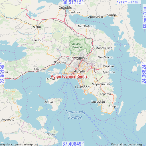
Agios Ioannis Rentis GPS coordinates[2]
37° 57' 53.676" North, 23° 39' 54.396" East
| Map corner | latitude | longitude |
|---|---|---|
| Upper-left | 38.51715°, | 22.96199° |
| Center: | 37.96491°, | 23.66511° |
| Lower-right: | 37.40849°, | 24.36824° |
| Map W x H: | 123.3×123.3 km | = 76.6×76.6mi |
| max Lat: | 41.72048° ⇑75.3% North |
| Agios Ioannis Rentis: | 37.96491° |
| min Lat: | ⇓24.7% South 34.8346° |
| min Long | Agios Ioannis R | max Long |
| 19.40494° | 23.66511° | 29.59361° |
| W 68.7%⇐ | ⇒31.3% E |
Elevation
Elevation of Agios Ioannis Rentis is 13 m = 43 ft, and this is 155.9 m = 511 ft below average elevation for this country.
| Max E: |
1439 m = 4721 ft | 84.7% |
| Avg. | 168.9 m = 554 ft | |
| Agios Ioannis Rentis | 13 m = 43 ft | |
Min E: |
0 m = 0 ft | 15.3% |
See also: Greece elevation on elevation.city.
Geographical zone
Agios Ioannis Rentis is located in North temperate zone (between Tropic of Cancer and the Arctic Circle). Distance of this Northern Tropic circle is 1615.4 km =1003.8 mi to South.| Distance of | km | miles | from Agios Ioannis Rentis |
|---|---|---|---|
| North Pole | 5785.8 | 3595.1 | to North |
| Arctic Circle | 3179.9 | 1975.9 | to North |
| Tropic Cancer | 1615.4 | 1003.8 | to South |
| Equator | 4221.3 | 2623 | to South |


Nearby cities:
15 places around Agios Ioannis Rentis: (largest is in red/bold)
• Agía Varvára
2.8 km =1.7 mi,  350°
350°
• Aigáleo
2.6 km =1.6 mi,  37°
37°
• Athens
5.9 km =3.7 mi,  69°
69°
• Chaïdári
5.2 km =3.2 mi,  0°
0°
• Drapetsóna
4 km =2.5 mi,  245°
245°
• Kallithéa
3.5 km =2.2 mi,  118°
118°
• Keratsíni
4 km =2.5 mi,  266°
266°
• Korydallós
2.7 km =1.7 mi,  324°
324°
• Moskháton
2.2 km =1.4 mi,  147°
147°
• Néa Smýrni
4.8 km =3 mi, 117°
• Níkaia
1.3 km =0.8 mi,  278°
278°
• Palaió Fáliro
5.2 km =3.2 mi,  142°
142°
• Peristéri
6.1 km =3.8 mi,  22°
22°
• Piraeus
3 km =1.9 mi,  213°
213°
• Távros
2.3 km =1.4 mi, 73°
Sources, notices
• [Note1] Compared only with cities in Greece existing in our database
• [Src1] Map data: © OpenStreetMap contributors (CC-BY-SA)
• [Src2] Other city data from geonames.org with taken over terms of usage.
• [Src3] Geographical zone / Annual Mean Temperature by Robert A. Rohde @ Wikipedia
