Kítsi geodata
Kítsi (Attica) is a populated place; located in Greece in Europe/Athens (GMT+3) time zone. With population of 4,788 people, there are 244 cities with bigger population in this country. Compared to other cities in Greece, 78.6% of cities are located further ↑North; 74.4% of cities are located further ←West and 54.8% of cities have lower elevation than Kítsi. Note1
Administrative division(s):
- Level 1: Attica
- Level 2: Nomarchía Anatolikís Attikís
- Level 3: Dimos Kropia


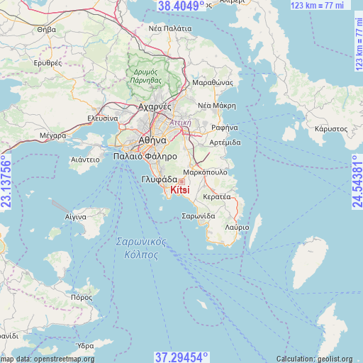
Kítsi GPS coordinates[2]
37° 51' 6.516" North, 23° 50' 26.448" East
| Map corner | latitude | longitude |
|---|---|---|
| Upper-left | 38.4049°, | 23.13756° |
| Center: | 37.85181°, | 23.84068° |
| Lower-right: | 37.29454°, | 24.54381° |
| Map W x H: | 123.5×123.5 km | = 76.7×76.7mi |
| max Lat: | 41.72048° ⇑78.6% North |
| Kítsi: | 37.85181° |
| min Lat: | ⇓21.4% South 34.8346° |
| min Long | Kítsi | max Long |
| 19.40494° | 23.84068° | 29.59361° |
| W 74.4%⇐ | ⇒25.6% E |
Elevation
Elevation of Kítsi is 98 m = 322 ft, and this is 70.9 m = 233 ft below average elevation for this country.
| Max E: |
1439 m = 4721 ft | 45.2% |
| Avg. | 168.9 m = 554 ft | |
| Kítsi | 98 m = 322 ft | |
Min E: |
0 m = 0 ft | 54.8% |
See also: Greece elevation on elevation.city.
Geographical zone
Kítsi is located in North temperate zone (between Tropic of Cancer and the Arctic Circle). Distance of this Northern Tropic circle is 1602.8 km =995.9 mi to South.| Distance of | km | miles | from Kítsi |
|---|---|---|---|
| North Pole | 5798.3 | 3602.9 | to North |
| Arctic Circle | 3192.4 | 1983.7 | to North |
| Tropic Cancer | 1602.8 | 995.9 | to South |
| Equator | 4208.7 | 2615.2 | to South |


Nearby cities:
15 places around Kítsi: (largest is in red/bold)
• Agios Dimítrios Kropiás
5.3 km =3.3 mi,  163°
163°
• Agía Marína
3.5 km =2.2 mi,  174°
174°
• Argyroúpoli
10 km =6.2 mi,  307°
307°
• Ellinikó
9.5 km =5.9 mi,  296°
296°
• Glyfáda
7.4 km =4.6 mi,  279°
279°
• Ilioúpoli
10.9 km =6.8 mi,  324°
324°
• Kalývia Thorikoú
7.5 km =4.7 mi,  100°
100°
• Karellás
9.4 km =5.8 mi,  12°
12°
• Koropí
5.9 km =3.7 mi,  27°
27°
• Kouvarás
11.4 km =7.1 mi, 103°
• Markópoulo
8.9 km =5.5 mi,  66°
66°
• Néos Kouvarás
10.5 km =6.5 mi,  106°
106°
• Vouliagméni
6.8 km =4.2 mi,  232°
232°
• Voúla
5.7 km =3.5 mi,  259°
259°
• Vári
3.9 km =2.4 mi,  237°
237°
Sources, notices
• [Note1] Compared only with cities in Greece existing in our database
• [Src1] Map data: © OpenStreetMap contributors (CC-BY-SA)
• [Src2] Other city data from geonames.org with taken over terms of usage.
• [Src3] Geographical zone / Annual Mean Temperature by Robert A. Rohde @ Wikipedia
