Vanáton geodata
Vanáton (Ionian Islands) is a populated place; located in Greece in Europe/Athens (GMT+3) time zone. With population of 1,045 people, there are 969 cities with bigger population in this country. Compared to other cities in Greece, 80.2% of cities are located further ↑North; 92.4% of cities are located further →East and 80.3% of cities have higher elevation than Vanáton. Note1
Administrative division(s):
- Level 1: Ionian Islands
- Level 2: Nomós Zakýnthou
- Level 3: Dimos Zakynthos


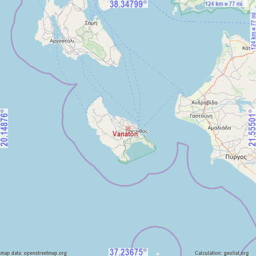
Vanáton GPS coordinates[2]
37° 47' 40.056" North, 20° 51' 6.768" East
| Map corner | latitude | longitude |
|---|---|---|
| Upper-left | 38.34799°, | 20.14876° |
| Center: | 37.79446°, | 20.85188° |
| Lower-right: | 37.23675°, | 21.55501° |
| Map W x H: | 123.6×123.6 km | = 76.8×76.8mi |
| max Lat: | 41.72048° ⇑80.2% North |
| Vanáton: | 37.79446° |
| min Lat: | ⇓19.8% South 34.8346° |
| min Long | Vanáton | max Long |
| 19.40494° | 20.85188° | 29.59361° |
| W 7.6%⇐ | ⇒92.4% E |
Elevation
Elevation of Vanáton is 17 m = 56 ft, and this is 151.9 m = 498 ft below average elevation for this country.
| Max E: |
1439 m = 4721 ft | 80.3% |
| Avg. | 168.9 m = 554 ft | |
| Vanáton | 17 m = 56 ft | |
Min E: |
0 m = 0 ft | 19.7% |
See also: Greece elevation on elevation.city.
Geographical zone
Vanáton is located in North temperate zone (between Tropic of Cancer and the Arctic Circle). Distance of this Northern Tropic circle is 1596.4 km =992 mi to South.| Distance of | km | miles | from Vanáton |
|---|---|---|---|
| North Pole | 5804.7 | 3606.9 | to North |
| Arctic Circle | 3198.8 | 1987.6 | to North |
| Tropic Cancer | 1596.4 | 992 | to South |
| Equator | 4202.4 | 2611.2 | to South |


Nearby cities:
15 places around Vanáton: (largest is in red/bold)
• Ambelókipoi
4.4 km =2.7 mi,  155°
155°
• Bókhali
3.5 km =2.2 mi,  94°
94°
• Gaïtánion
2 km =1.2 mi,  100°
100°
• Kalipádhon
1.4 km =0.9 mi,  299°
299°
• Kallitéros
5.9 km =3.7 mi,  133°
133°
• Kipséli
3.7 km =2.3 mi,  316°
316°
• Makhairádhon
5.5 km =3.4 mi,  222°
222°
• Plános
2.7 km =1.7 mi,  24°
24°
• Romírion
5.9 km =3.7 mi,  210°
210°
• Sarakinádhon
0.6 km =0.4 mi, 210°
• Skoulikádo
5.9 km =3.7 mi,  277°
277°
• Tragákion
2.6 km =1.6 mi, 319°
• Zakynthos
4.2 km =2.6 mi,  112°
112°
• Áyios Dhimítrios
4.8 km =3 mi, 276°
• Áyios Kírikos
2 km =1.2 mi,  247°
247°
Sources, notices
• [Note1] Compared only with cities in Greece existing in our database
• [Src1] Map data: © OpenStreetMap contributors (CC-BY-SA)
• [Src2] Other city data from geonames.org with taken over terms of usage.
• [Src3] Geographical zone / Annual Mean Temperature by Robert A. Rohde @ Wikipedia
