Sarakinádhon geodata
Sarakinádhon (Ionian Islands) is a populated place; located in Greece in Europe/Athens (GMT+3) time zone. With population of 619 people, there are 1549 cities with bigger population in this country. Compared to other cities in Greece, 80.5% of cities are located further ↑North; 92.4% of cities are located further →East and 87.7% of cities have higher elevation than Sarakinádhon. Note1
Administrative division(s):
- Level 1: Ionian Islands
- Level 2: Nomós Zakýnthou
- Level 3: Dimos Zakynthos


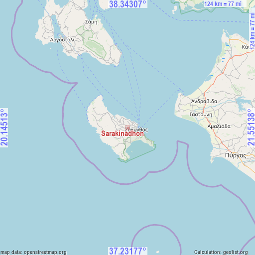
Sarakinádhon GPS coordinates[2]
37° 47' 22.236" North, 20° 50' 53.7" East
| Map corner | latitude | longitude |
|---|---|---|
| Upper-left | 38.34307°, | 20.14513° |
| Center: | 37.78951°, | 20.84825° |
| Lower-right: | 37.23177°, | 21.55138° |
| Map W x H: | 123.6×123.6 km | = 76.8×76.8mi |
| max Lat: | 41.72048° ⇑80.5% North |
| Sarakinádhon: | 37.78951° |
| min Lat: | ⇓19.5% South 34.8346° |
| min Long | Sarakinádhon | max Long |
| 19.40494° | 20.84825° | 29.59361° |
| W 7.6%⇐ | ⇒92.4% E |
Elevation
Elevation of Sarakinádhon is 10 m = 33 ft, and this is 158.9 m = 521 ft below average elevation for this country.
| Max E: |
1439 m = 4721 ft | 87.7% |
| Avg. | 168.9 m = 554 ft | |
| Sarakinádhon | 10 m = 33 ft | |
Min E: |
0 m = 0 ft | 12.3% |
See also: Greece elevation on elevation.city.
Geographical zone
Sarakinádhon is located in North temperate zone (between Tropic of Cancer and the Arctic Circle). Distance of this Northern Tropic circle is 1595.9 km =991.6 mi to South.| Distance of | km | miles | from Sarakinádhon |
|---|---|---|---|
| North Pole | 5805.3 | 3607.2 | to North |
| Arctic Circle | 3199.4 | 1988 | to North |
| Tropic Cancer | 1595.9 | 991.6 | to South |
| Equator | 4201.8 | 2610.9 | to South |


Nearby cities:
15 places around Sarakinádhon: (largest is in red/bold)
• Ambelókipoi
4.1 km =2.5 mi,  148°
148°
• Bókhali
3.8 km =2.4 mi,  85°
85°
• Gaïtánion
2.3 km =1.4 mi,  84°
84°
• Kalipádhon
1.6 km =1 mi,  324°
324°
• Kallitéros
5.8 km =3.6 mi,  127°
127°
• Kipséli
4 km =2.5 mi,  325°
325°
• Makhairádhon
4.8 km =3 mi,  223°
223°
• Plános
3.3 km =2.1 mi,  25°
25°
• Romírion
5.3 km =3.3 mi,  210°
210°
• Skoulikádo
5.7 km =3.5 mi,  283°
283°
• Tragákion
2.9 km =1.8 mi, 331°
• Vanáton
0.6 km =0.4 mi, 30°
• Zakynthos
4.3 km =2.7 mi,  103°
103°
• Áyios Dhimítrios
4.6 km =2.9 mi, 284°
• Áyios Kírikos
1.5 km =0.9 mi,  262°
262°
Sources, notices
• [Note1] Compared only with cities in Greece existing in our database
• [Src1] Map data: © OpenStreetMap contributors (CC-BY-SA)
• [Src2] Other city data from geonames.org with taken over terms of usage.
• [Src3] Geographical zone / Annual Mean Temperature by Robert A. Rohde @ Wikipedia
