Rizovoúni geodata
Rizovoúni (Thessaly) is a populated place; located in Greece in Europe/Athens (GMT+3) time zone. With population of 501 people, there are 1802 cities with bigger population in this country. Compared to other cities in Greece, 54.8% of cities are located further ↓South; 74.7% of cities are located further →East and 54% of cities have lower elevation than Rizovoúni. Note1


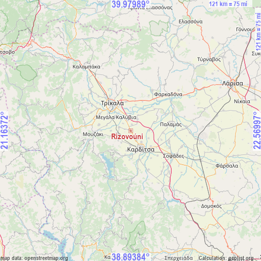
Rizovoúni GPS coordinates[2]
39° 26' 20.328" North, 21° 52' 0.624" East
| Map corner | latitude | longitude |
|---|---|---|
| Upper-left | 39.97989°, | 21.16372° |
| Center: | 39.43898°, | 21.86684° |
| Lower-right: | 38.89384°, | 22.56997° |
| Map W x H: | 120.8×120.8 km | = 75.1×75.1mi |
| max Lat: | 41.72048° ⇑45.2% North |
| Rizovoúni: | 39.43898° |
| min Lat: | ⇓54.8% South 34.8346° |
| min Long | Rizovoúni | max Long |
| 19.40494° | 21.86684° | 29.59361° |
| W 25.3%⇐ | ⇒74.7% E |
Elevation
Elevation of Rizovoúni is 96 m = 315 ft, and this is 72.9 m = 239 ft below average elevation for this country.
| Max E: |
1439 m = 4721 ft | 46% |
| Avg. | 168.9 m = 554 ft | |
| Rizovoúni | 96 m = 315 ft | |
Min E: |
0 m = 0 ft | 54% |
See also: Greece elevation on elevation.city.
Geographical zone
Rizovoúni is located in North temperate zone (between Tropic of Cancer and the Arctic Circle). Distance of this Northern Tropic circle is 1779.3 km =1105.6 mi to South.| Distance of | km | miles | from Rizovoúni |
|---|---|---|---|
| North Pole | 5621.9 | 3493.3 | to North |
| Arctic Circle | 3016 | 1874.1 | to North |
| Tropic Cancer | 1779.3 | 1105.6 | to South |
| Equator | 4385.2 | 2724.8 | to South |


Nearby cities:
15 places around Rizovoúni: (largest is in red/bold)
• Agnanteró
5.5 km =3.4 mi,  342°
342°
• Agía Triáda
3.9 km =2.4 mi,  44°
44°
• Artesianó
4.8 km =3 mi,  148°
148°
• Fanári
6.4 km =4 mi,  246°
246°
• Glínos
8.1 km =5 mi,  358°
358°
• Kalogrianá
3 km =1.9 mi,  10°
10°
• Kanália
7.3 km =4.5 mi,  232°
232°
• Karditsomagoúla
7.2 km =4.5 mi,  137°
137°
• Kraniá
2.9 km =1.8 mi,  285°
285°
• Magoúla
5.7 km =3.5 mi, 287°
• Makrychóri
8.5 km =5.3 mi,  89°
89°
• Palaiochóri
5 km =3.1 mi,  313°
313°
• Palaiokklísi
6.9 km =4.3 mi,  181°
181°
• Proástio
6.2 km =3.9 mi,  30°
30°
• Servotá
8.1 km =5 mi, 25°
Sources, notices
• [Note1] Compared only with cities in Greece existing in our database
• [Src1] Map data: © OpenStreetMap contributors (CC-BY-SA)
• [Src2] Other city data from geonames.org with taken over terms of usage.
• [Src3] Geographical zone / Annual Mean Temperature by Robert A. Rohde @ Wikipedia
