Psathópyrgos geodata
Psathópyrgos (West Greece) is a populated place; located in Greece in Europe/Athens (GMT+3) time zone. With population of 663 people, there are 1473 cities with bigger population in this country. Compared to other cities in Greece, 65.2% of cities are located further ↑North; 74.6% of cities are located further →East and 90.7% of cities have higher elevation than Psathópyrgos. Note1


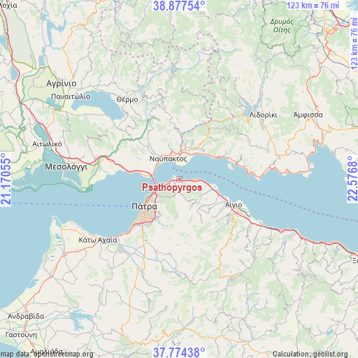
Psathópyrgos GPS coordinates[2]
38° 19' 41.016" North, 21° 52' 25.212" East
| Map corner | latitude | longitude |
|---|---|---|
| Upper-left | 38.87754°, | 21.17055° |
| Center: | 38.32806°, | 21.87367° |
| Lower-right: | 37.77438°, | 22.5768° |
| Map W x H: | 122.7×122.7 km | = 76.2×76.2mi |
| max Lat: | 41.72048° ⇑65.2% North |
| Psathópyrgos: | 38.32806° |
| min Lat: | ⇓34.8% South 34.8346° |
| min Long | Psathópyrgos | max Long |
| 19.40494° | 21.87367° | 29.59361° |
| W 25.4%⇐ | ⇒74.6% E |
Elevation
Elevation of Psathópyrgos is 8 m = 26 ft, and this is 160.9 m = 528 ft below average elevation for this country.
| Max E: |
1439 m = 4721 ft | 90.7% |
| Avg. | 168.9 m = 554 ft | |
| Psathópyrgos | 8 m = 26 ft | |
Min E: |
0 m = 0 ft | 9.3% |
See also: Greece elevation on elevation.city.
Geographical zone
Psathópyrgos is located in North temperate zone (between Tropic of Cancer and the Arctic Circle). Distance of this Northern Tropic circle is 1655.8 km =1028.9 mi to South.| Distance of | km | miles | from Psathópyrgos |
|---|---|---|---|
| North Pole | 5745.4 | 3570 | to North |
| Arctic Circle | 3139.5 | 1950.8 | to North |
| Tropic Cancer | 1655.8 | 1028.9 | to South |
| Equator | 4261.7 | 2648.1 | to South |


Nearby cities:
15 places around Psathópyrgos: (largest is in red/bold)
• Aktaío
7.4 km =4.6 mi,  249°
249°
• Antirrio
9.6 km =6 mi,  271°
271°
• Aígio
20.2 km =12.6 mi,  115°
115°
• Drépano
2 km =1.2 mi, 248°
• Kamárai
11.4 km =7.1 mi,  106°
106°
• Kastráki
10.1 km =6.3 mi,  11°
11°
• Káto Arachovítika
2.7 km =1.7 mi, 272°
• Lóngos
13.4 km =8.3 mi, 106°
• Náfpaktos
8.1 km =5 mi,  330°
330°
• Ovriá
20 km =12.4 mi,  219°
219°
• Pátra
15.3 km =9.5 mi,  232°
232°
• Rododáfni
16.6 km =10.3 mi, 112°
• Río
8.5 km =5.3 mi,  244°
244°
• Selianítika
14.4 km =8.9 mi, 110°
• Áno Kastrítsi
7 km =4.3 mi,  207°
207°
Sources, notices
• [Note1] Compared only with cities in Greece existing in our database
• [Src1] Map data: © OpenStreetMap contributors (CC-BY-SA)
• [Src2] Other city data from geonames.org with taken over terms of usage.
• [Src3] Geographical zone / Annual Mean Temperature by Robert A. Rohde @ Wikipedia
