Parákoila geodata
Parákoila (North Aegean) is a populated place; located in Greece in Europe/Athens (GMT+3) time zone. With population of 881 people, there are 1157 cities with bigger population in this country. Compared to other cities in Greece, 50.8% of cities are located further ↑North; 94.3% of cities are located further ←West and 59.6% of cities have higher elevation than Parákoila. Note1


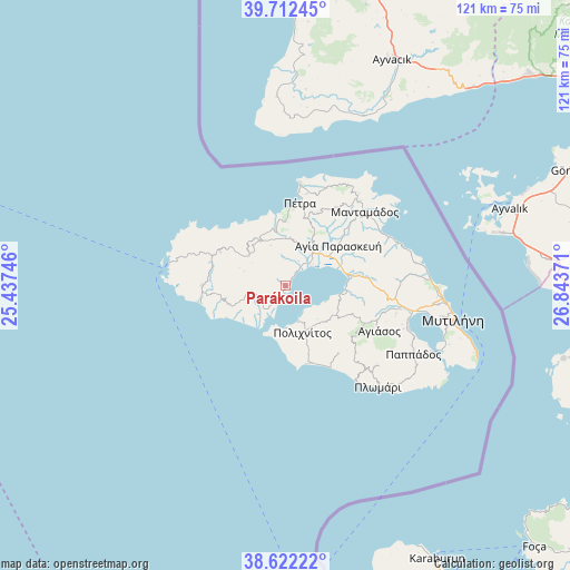
Parákoila GPS coordinates[2]
39° 10' 10.02" North, 26° 8' 26.088" East
| Map corner | latitude | longitude |
|---|---|---|
| Upper-left | 39.71245°, | 25.43746° |
| Center: | 39.16945°, | 26.14058° |
| Lower-right: | 38.62222°, | 26.84371° |
| Map W x H: | 121.2×121.2 km | = 75.3×75.3mi |
| max Lat: | 41.72048° ⇑50.8% North |
| Parákoila: | 39.16945° |
| min Lat: | ⇓49.2% South 34.8346° |
| min Long | Parákoila | max Long |
| 19.40494° | 26.14058° | 29.59361° |
| W 94.3%⇐ | ⇒5.7% E |
Elevation
Elevation of Parákoila is 51 m = 167 ft, and this is 117.9 m = 387 ft below average elevation for this country.
| Max E: |
1439 m = 4721 ft | 59.6% |
| Avg. | 168.9 m = 554 ft | |
| Parákoila | 51 m = 167 ft | |
Min E: |
0 m = 0 ft | 40.4% |
See also: Greece elevation on elevation.city.
Geographical zone
Parákoila is located in North temperate zone (between Tropic of Cancer and the Arctic Circle). Distance of this Northern Tropic circle is 1749.3 km =1087 mi to South.| Distance of | km | miles | from Parákoila |
|---|---|---|---|
| North Pole | 5651.8 | 3511.9 | to North |
| Arctic Circle | 3045.9 | 1892.6 | to North |
| Tropic Cancer | 1749.3 | 1087 | to South |
| Equator | 4355.2 | 2706.2 | to South |


Nearby cities:
15 places around Parákoila: (largest is in red/bold)
• Agía Paraskeví
14.3 km =8.9 mi,  52°
52°
• Dáfia
9.5 km =5.9 mi,  32°
32°
• Fília
10.3 km =6.4 mi,  359°
359°
• Kalloní
9.1 km =5.7 mi,  39°
39°
• Kerámion
7.8 km =4.8 mi, 47°
• Mesótopos
12.6 km =7.8 mi,  250°
250°
• Polichnítos
10.7 km =6.6 mi,  160°
160°
• Pétra
17.8 km =11.1 mi,  10°
10°
• Skalokhóri
11.4 km =7.1 mi,  330°
330°
• Skoutáros
13.7 km =8.5 mi, 357°
• Stýpsi
17.2 km =10.7 mi,  23°
23°
• Vatoússa
9.9 km =6.2 mi,  309°
309°
• Vrísa
15.3 km =9.5 mi, 160°
• Ágra
7 km =4.3 mi,  259°
259°
• Ántissa
15.6 km =9.7 mi,  297°
297°
Sources, notices
• [Note1] Compared only with cities in Greece existing in our database
• [Src1] Map data: © OpenStreetMap contributors (CC-BY-SA)
• [Src2] Other city data from geonames.org with taken over terms of usage.
• [Src3] Geographical zone / Annual Mean Temperature by Robert A. Rohde @ Wikipedia
