Oropós geodata
Oropós (Attica) is a seat of a third-order administrative division; located in Greece in Europe/Athens (GMT+3) time zone. With population of 1,111 people, there are 908 cities with bigger population in this country. Compared to other cities in Greece, 65.9% of cities are located further ↑North; 71.6% of cities are located further ←West and 69.6% of cities have higher elevation than Oropós. Note1
Administrative division(s):
- Level 1: Attica
- Level 2: Nomarchía Anatolikís Attikís
- Level 3: Dimos Oropos


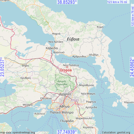
Oropós GPS coordinates[2]
38° 18' 11.736" North, 23° 45' 19.764" East
| Map corner | latitude | longitude |
|---|---|---|
| Upper-left | 38.85293°, | 23.05237° |
| Center: | 38.30326°, | 23.75549° |
| Lower-right: | 37.74939°, | 24.45862° |
| Map W x H: | 122.7×122.7 km | = 76.2×76.2mi |
| max Lat: | 41.72048° ⇑65.9% North |
| Oropós: | 38.30326° |
| min Lat: | ⇓34.1% South 34.8346° |
| min Long | Oropós | max Long |
| 19.40494° | 23.75549° | 29.59361° |
| W 71.6%⇐ | ⇒28.4% E |
Elevation
Elevation of Oropós is 32 m = 105 ft, and this is 136.9 m = 449 ft below average elevation for this country.
| Max E: |
1439 m = 4721 ft | 69.6% |
| Avg. | 168.9 m = 554 ft | |
| Oropós | 32 m = 105 ft | |
Min E: |
0 m = 0 ft | 30.4% |
See also: Greece elevation on elevation.city.
Geographical zone
Oropós is located in North temperate zone (between Tropic of Cancer and the Arctic Circle). Distance of this Northern Tropic circle is 1653 km =1027.1 mi to South.| Distance of | km | miles | from Oropós |
|---|---|---|---|
| North Pole | 5748.1 | 3571.7 | to North |
| Arctic Circle | 3142.3 | 1952.5 | to North |
| Tropic Cancer | 1653 | 1027.1 | to South |
| Equator | 4258.9 | 2646.4 | to South |


Nearby cities:
15 places around Oropós: (largest is in red/bold)
• Agía Triáda
11.9 km =7.4 mi,  159°
159°
• Avlónas
7.8 km =4.8 mi,  222°
222°
• Dílesi
8.3 km =5.2 mi,  297°
297°
• Erétria
11.6 km =7.2 mi,  20°
20°
• Khalkoútsion
3.9 km =2.4 mi,  327°
327°
• Kálamos
9.6 km =6 mi,  102°
102°
• Malakása
8.3 km =5.2 mi,  151°
151°
• Malakónta
10.8 km =6.7 mi,  5°
5°
• Markópoulo Oropoú
6.2 km =3.9 mi, 103°
• Néa Palátia
4 km =2.5 mi,  63°
63°
• Néa Politeía
2.7 km =1.7 mi,  92°
92°
• Oinófyta
10.1 km =6.3 mi,  275°
275°
• Pláka Dílesi
10.5 km =6.5 mi, 299°
• Skála Oropoú
3.3 km =2.1 mi, 56°
• Sykámino
2.2 km =1.4 mi,  267°
267°
Sources, notices
• [Note1] Compared only with cities in Greece existing in our database
• [Src1] Map data: © OpenStreetMap contributors (CC-BY-SA)
• [Src2] Other city data from geonames.org with taken over terms of usage.
• [Src3] Geographical zone / Annual Mean Temperature by Robert A. Rohde @ Wikipedia
