Oinófyta geodata
Oinófyta (Central Greece) is a populated place; located in Greece in Europe/Athens (GMT+3) time zone. With population of 2,927 people, there are 362 cities with bigger population in this country. Compared to other cities in Greece, 65.6% of cities are located further ↑North; 67.7% of cities are located further ←West and 56.2% of cities have lower elevation than Oinófyta. Note1


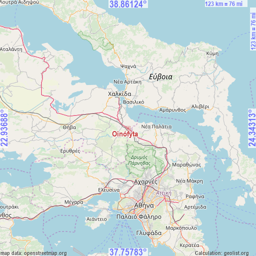
Oinófyta GPS coordinates[2]
38° 18' 41.868" North, 23° 38' 24" East
| Map corner | latitude | longitude |
|---|---|---|
| Upper-left | 38.86124°, | 22.93688° |
| Center: | 38.31163°, | 23.64° |
| Lower-right: | 37.75783°, | 24.34313° |
| Map W x H: | 122.7×122.7 km | = 76.2×76.2mi |
| max Lat: | 41.72048° ⇑65.6% North |
| Oinófyta: | 38.31163° |
| min Lat: | ⇓34.4% South 34.8346° |
| min Long | Oinófyta | max Long |
| 19.40494° | 23.64° | 29.59361° |
| W 67.7%⇐ | ⇒32.3% E |
Elevation
Elevation of Oinófyta is 102 m = 335 ft, and this is 66.9 m = 219 ft below average elevation for this country.
| Max E: |
1439 m = 4721 ft | 43.8% |
| Avg. | 168.9 m = 554 ft | |
| Oinófyta | 102 m = 335 ft | |
Min E: |
0 m = 0 ft | 56.2% |
See also: Greece elevation on elevation.city.
Geographical zone
Oinófyta is located in North temperate zone (between Tropic of Cancer and the Arctic Circle). Distance of this Northern Tropic circle is 1653.9 km =1027.7 mi to South.| Distance of | km | miles | from Oinófyta |
|---|---|---|---|
| North Pole | 5747.2 | 3571.1 | to North |
| Arctic Circle | 3141.3 | 1951.9 | to North |
| Tropic Cancer | 1653.9 | 1027.7 | to South |
| Equator | 4259.9 | 2647 | to South |


Nearby cities:
15 places around Oinófyta: (largest is in red/bold)
• Asopía
12.1 km =7.5 mi,  263°
263°
• Avlónas
8.3 km =5.2 mi,  144°
144°
• Dílesi
3.9 km =2.4 mi,  42°
42°
• Fáros
9.9 km =6.2 mi,  351°
351°
• Kalochóri - Panteíchi
9.3 km =5.8 mi,  335°
335°
• Khalkoútsion
8.3 km =5.2 mi,  73°
73°
• Oropós
10.1 km =6.3 mi,  95°
95°
• Paralía Avlídhos
7.7 km =4.8 mi, 352°
• Paralía Vathéos
11.8 km =7.3 mi, 348°
• Pláka Dílesi
4.3 km =2.7 mi,  12°
12°
• Schimatári
6.5 km =4 mi,  310°
310°
• Sykámino
7.9 km =4.9 mi, 97°
• Vathí
10.9 km =6.8 mi, 342°
• Áyios Nikólaos
12.1 km =7.5 mi,  3°
3°
• Áyios Thomás
5.9 km =3.7 mi,  229°
229°
Sources, notices
• [Note1] Compared only with cities in Greece existing in our database
• [Src1] Map data: © OpenStreetMap contributors (CC-BY-SA)
• [Src2] Other city data from geonames.org with taken over terms of usage.
• [Src3] Geographical zone / Annual Mean Temperature by Robert A. Rohde @ Wikipedia
