Kavoúsi geodata
Kavoúsi (Crete) is a populated place; located in Greece in Europe/Athens (GMT+3) time zone. With population of 559 people, there are 1681 cities with bigger population in this country. Compared to other cities in Greece, 98.7% of cities are located further ↑North; 92.5% of cities are located further ←West and 59.3% of cities have lower elevation than Kavoúsi. Note1


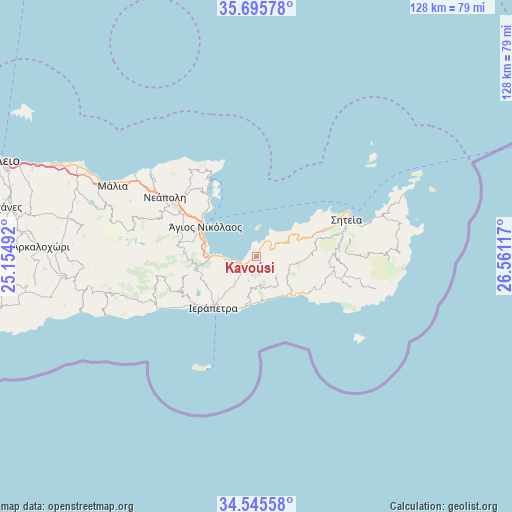
Kavoúsi GPS coordinates[2]
35° 7' 21.756" North, 25° 51' 28.944" East
| Map corner | latitude | longitude |
|---|---|---|
| Upper-left | 35.69578°, | 25.15492° |
| Center: | 35.12271°, | 25.85804° |
| Lower-right: | 34.54558°, | 26.56117° |
| Map W x H: | 127.9×127.9 km | = 79.5×79.5mi |
| max Lat: | 41.72048° ⇑98.7% North |
| Kavoúsi: | 35.12271° |
| min Lat: | ⇓1.3% South 34.8346° |
| min Long | Kavoúsi | max Long |
| 19.40494° | 25.85804° | 29.59361° |
| W 92.5%⇐ | ⇒7.5% E |
Elevation
Elevation of Kavoúsi is 114 m = 374 ft, and this is 54.9 m = 180 ft below average elevation for this country.
| Max E: |
1439 m = 4721 ft | 40.7% |
| Avg. | 168.9 m = 554 ft | |
| Kavoúsi | 114 m = 374 ft | |
Min E: |
0 m = 0 ft | 59.3% |
See also: Greece elevation on elevation.city.
Geographical zone
Kavoúsi is located in North temperate zone (between Tropic of Cancer and the Arctic Circle). Distance of this Northern Tropic circle is 1299.4 km =807.4 mi to South.| Distance of | km | miles | from Kavoúsi |
|---|---|---|---|
| North Pole | 6101.8 | 3791.5 | to North |
| Arctic Circle | 3495.9 | 2172.3 | to North |
| Tropic Cancer | 1299.4 | 807.4 | to South |
| Equator | 3905.3 | 2426.6 | to South |


Nearby cities:
15 places around Kavoúsi: (largest is in red/bold)
• Análipsi
14.5 km =9 mi,  129°
129°
• Férma
11.5 km =7.1 mi,  181°
181°
• Gra Liyiá
19.4 km =12.1 mi,  231°
231°
• Ierápetra
16.2 km =10.1 mi,  220°
220°
• Kentrí
13.9 km =8.6 mi, 223°
• Koutsounári
12.3 km =7.6 mi,  192°
192°
• Koutsourás
12.8 km =8 mi,  140°
140°
• Káto Chorió
10.3 km =6.4 mi, 216°
• Makry-Gialos
14.1 km =8.8 mi, 132°
• Pacheía Ámmos
4.7 km =2.9 mi,  251°
251°
• Schísma Eloúndas
19.1 km =11.9 mi,  321°
321°
• Vaïniá
13.4 km =8.3 mi, 215°
• Xirókambos
17 km =10.6 mi,  303°
303°
• Ágios Nikólaos
15 km =9.3 mi, 300°
• Ístro
10.8 km =6.7 mi,  271°
271°
Sources, notices
• [Note1] Compared only with cities in Greece existing in our database
• [Src1] Map data: © OpenStreetMap contributors (CC-BY-SA)
• [Src2] Other city data from geonames.org with taken over terms of usage.
• [Src3] Geographical zone / Annual Mean Temperature by Robert A. Rohde @ Wikipedia
