Makry-Gialos geodata
Makry-Gialos (Crete) is a populated place; located in Greece in Europe/Athens (GMT+3) time zone. With population of 760 people, there are 1319 cities with bigger population in this country. Compared to other cities in Greece, 99.3% of cities are located further ↑North; 92.7% of cities are located further ←West and 80.3% of cities have higher elevation than Makry-Gialos. Note1


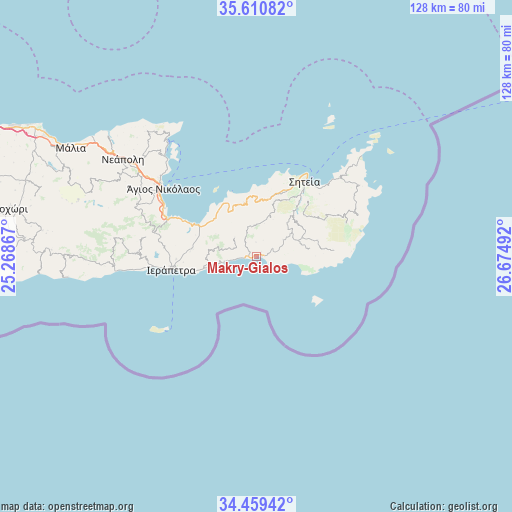
Makry-Gialos GPS coordinates[2]
35° 2' 13.74" North, 25° 58' 18.444" East
| Map corner | latitude | longitude |
|---|---|---|
| Upper-left | 35.61082°, | 25.26867° |
| Center: | 35.03715°, | 25.97179° |
| Lower-right: | 34.45942°, | 26.67492° |
| Map W x H: | 128×128 km | = 79.5×79.5mi |
| max Lat: | 41.72048° ⇑99.3% North |
| Makry-Gialos: | 35.03715° |
| min Lat: | ⇓0.7% South 34.8346° |
| min Long | Makry-Gialos | max Long |
| 19.40494° | 25.97179° | 29.59361° |
| W 92.7%⇐ | ⇒7.3% E |
Elevation
Elevation of Makry-Gialos is 17 m = 56 ft, and this is 151.9 m = 498 ft below average elevation for this country.
| Max E: |
1439 m = 4721 ft | 80.3% |
| Avg. | 168.9 m = 554 ft | |
| Makry-Gialos | 17 m = 56 ft | |
Min E: |
0 m = 0 ft | 19.7% |
See also: Greece elevation on elevation.city.
Geographical zone
Makry-Gialos is located in North temperate zone (between Tropic of Cancer and the Arctic Circle). Distance of this Northern Tropic circle is 1289.8 km =801.4 mi to South.| Distance of | km | miles | from Makry-Gialos |
|---|---|---|---|
| North Pole | 6111.3 | 3797.4 | to North |
| Arctic Circle | 3505.4 | 2178.2 | to North |
| Tropic Cancer | 1289.8 | 801.4 | to South |
| Equator | 3895.8 | 2420.7 | to South |


Nearby cities:
15 places around Makry-Gialos: (largest is in red/bold)
• Análipsi
0.9 km =0.6 mi,  68°
68°
• Férma
10.9 km =6.8 mi,  259°
259°
• Gra Liyiá
25.7 km =16 mi, 264°
• Ierápetra
21.1 km =13.1 mi, 262°
• Kavoúsi
14.1 km =8.8 mi,  312°
312°
• Kentrí
19.9 km =12.4 mi,  268°
268°
• Koutsounári
13.2 km =8.2 mi, 259°
• Koutsourás
2.3 km =1.4 mi, 259°
• Káto Chorió
16.5 km =10.3 mi, 274°
• Néa Anatolí
28.4 km =17.6 mi, 263°
• Pacheía Ámmos
16.8 km =10.4 mi,  298°
298°
• Sitia
22.5 km =14 mi,  32°
32°
• Vaïniá
18.2 km =11.3 mi, 265°
• Ágios Nikólaos
28.9 km =18 mi, 306°
• Ístro
23.3 km =14.5 mi,  294°
294°
Sources, notices
• [Note1] Compared only with cities in Greece existing in our database
• [Src1] Map data: © OpenStreetMap contributors (CC-BY-SA)
• [Src2] Other city data from geonames.org with taken over terms of usage.
• [Src3] Geographical zone / Annual Mean Temperature by Robert A. Rohde @ Wikipedia
