Kalloní geodata
Kalloní (Attica) is a populated place; located in Greece in Europe/Athens (GMT+3) time zone. With population of 669 people, there are 1463 cities with bigger population in this country. Compared to other cities in Greece, 85.6% of cities are located further ↑North; 60.2% of cities are located further ←West and 67.6% of cities have higher elevation than Kalloní. Note1


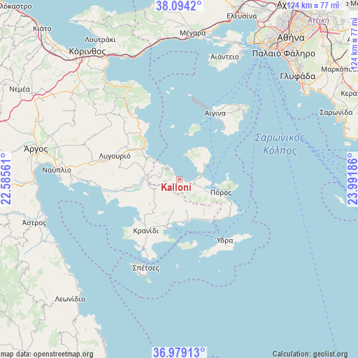
Kalloní GPS coordinates[2]
37° 32' 19.5" North, 23° 17' 19.428" East
| Map corner | latitude | longitude |
|---|---|---|
| Upper-left | 38.0942°, | 22.58561° |
| Center: | 37.53875°, | 23.28873° |
| Lower-right: | 36.97913°, | 23.99186° |
| Map W x H: | 124×124 km | = 77.1×77.1mi |
| max Lat: | 41.72048° ⇑85.6% North |
| Kalloní: | 37.53875° |
| min Lat: | ⇓14.4% South 34.8346° |
| min Long | Kalloní | max Long |
| 19.40494° | 23.28873° | 29.59361° |
| W 60.2%⇐ | ⇒39.8% E |
Elevation
Elevation of Kalloní is 35 m = 115 ft, and this is 133.9 m = 439 ft below average elevation for this country.
| Max E: |
1439 m = 4721 ft | 67.6% |
| Avg. | 168.9 m = 554 ft | |
| Kalloní | 35 m = 115 ft | |
Min E: |
0 m = 0 ft | 32.4% |
See also: Greece elevation on elevation.city.
Geographical zone
Kalloní is located in North temperate zone (between Tropic of Cancer and the Arctic Circle). Distance of this Northern Tropic circle is 1568 km =974.3 mi to South.| Distance of | km | miles | from Kalloní |
|---|---|---|---|
| North Pole | 5833.1 | 3624.5 | to North |
| Arctic Circle | 3227.3 | 2005.4 | to North |
| Tropic Cancer | 1568 | 974.3 | to South |
| Equator | 4173.9 | 2593.5 | to South |


Nearby cities:
15 places around Kalloní: (largest is in red/bold)
• Aegina
26.1 km =16.2 mi,  27°
27°
• Dídyma
13.3 km =8.3 mi,  230°
230°
• Ermióni
17.5 km =10.9 mi,  192°
192°
• Galatás
14.9 km =9.3 mi,  108°
108°
• Iliókastron
10.6 km =6.6 mi, 190°
• Koilás
20.1 km =12.5 mi, 225°
• Kranídi
21 km =13 mi,  212°
212°
• Ligourión
23.6 km =14.7 mi,  290°
290°
• Megalochóri
19.8 km =12.3 mi,  14°
14°
• Méthana
10.1 km =6.3 mi,  62°
62°
• Néa Epídavros
20.9 km =13 mi,  317°
317°
• Palaiá Epídavros
16.1 km =10 mi,  313°
313°
• Pérdhika
22.4 km =13.9 mi,  40°
40°
• Póros
15.2 km =9.4 mi, 106°
• Troizína
8 km =5 mi,  125°
125°
Sources, notices
• [Note1] Compared only with cities in Greece existing in our database
• [Src1] Map data: © OpenStreetMap contributors (CC-BY-SA)
• [Src2] Other city data from geonames.org with taken over terms of usage.
• [Src3] Geographical zone / Annual Mean Temperature by Robert A. Rohde @ Wikipedia
