Eloúnda geodata
Eloúnda (Crete) is a populated place(s); located in Greece in Europe/Athens (GMT+3) time zone. With population of 2,193 people, there are 473 cities with bigger population in this country. Compared to other cities in Greece, 97.1% of cities are located further ↑North; 91.9% of cities are located further ←West and 98.8% of cities have higher elevation than Eloúnda. Note1


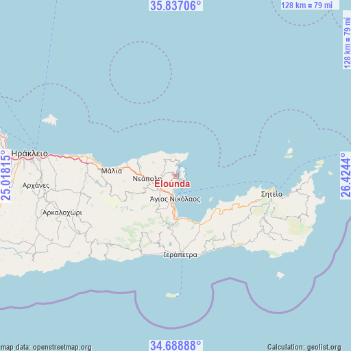
Eloúnda GPS coordinates[2]
35° 15' 54" North, 25° 43' 16.572" East
| Map corner | latitude | longitude |
|---|---|---|
| Upper-left | 35.83706°, | 25.01815° |
| Center: | 35.265°, | 25.72127° |
| Lower-right: | 34.68888°, | 26.4244° |
| Map W x H: | 127.7×127.7 km | = 79.3×79.3mi |
| max Lat: | 41.72048° ⇑97.1% North |
| Eloúnda: | 35.265° |
| min Lat: | ⇓2.9% South 34.8346° |
| min Long | Eloúnda | max Long |
| 19.40494° | 25.72127° | 29.59361° |
| W 91.9%⇐ | ⇒8.1% E |
Elevation
Elevation of Eloúnda is 2 m = 7 ft, and this is 166.9 m = 548 ft below average elevation for this country.
| Max E: |
1439 m = 4721 ft | 98.8% |
| Avg. | 168.9 m = 554 ft | |
| Eloúnda | 2 m = 7 ft | |
Min E: |
0 m = 0 ft | 1.2% |
See also: Greece elevation on elevation.city.
Geographical zone
Eloúnda is located in North temperate zone (between Tropic of Cancer and the Arctic Circle). Distance of this Northern Tropic circle is 1315.2 km =817.2 mi to South.| Distance of | km | miles | from Eloúnda |
|---|---|---|---|
| North Pole | 6086 | 3781.7 | to North |
| Arctic Circle | 3480.1 | 2162.4 | to North |
| Tropic Cancer | 1315.2 | 817.2 | to South |
| Equator | 3921.1 | 2436.5 | to South |


Nearby cities:
15 places around Eloúnda: (largest is in red/bold)
• Kavoúsi
20.1 km =12.5 mi,  141°
141°
• Kentrí
26 km =16.2 mi,  173°
173°
• Kritsá
13.8 km =8.6 mi,  210°
210°
• Káto Chorió
24.9 km =15.5 mi, 165°
• Mália
23.6 km =14.7 mi,  275°
275°
• Neápoli
10.7 km =6.6 mi,  264°
264°
• Pacheía Ámmos
19.1 km =11.9 mi,  155°
155°
• Schísma Eloúndas
1 km =0.6 mi, 143°
• Stalís
26.4 km =16.4 mi, 276°
• Sísion
18.9 km =11.7 mi, 284°
• Tzermiádon
22.4 km =13.9 mi,  250°
250°
• Vaïniá
27.1 km =16.8 mi, 170°
• Xirókambos
6.8 km =4.2 mi,  195°
195°
• Ágios Nikólaos
8.2 km =5.1 mi,  183°
183°
• Ístro
15.7 km =9.8 mi, 174°
Sources, notices
• [Note1] Compared only with cities in Greece existing in our database
• [Src1] Map data: © OpenStreetMap contributors (CC-BY-SA)
• [Src2] Other city data from geonames.org with taken over terms of usage.
• [Src3] Geographical zone / Annual Mean Temperature by Robert A. Rohde @ Wikipedia
