Gérmas geodata
Gérmas (West Macedonia) is a populated place; located in Greece in Europe/Athens (GMT+3) time zone. With population of 560 people, there are 1679 cities with bigger population in this country. Compared to other cities in Greece, 73% of cities are located further ↓South; 84% of cities are located further →East and 97% of cities have lower elevation than Gérmas. Note1
Administrative division(s):
- Level 1: West Macedonia
- Level 2: Nomós Kastoriás
- Level 3: Dimos Orestida


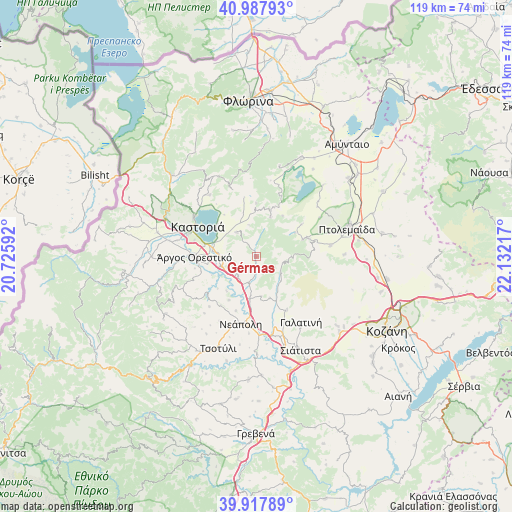
Gérmas GPS coordinates[2]
40° 27' 18.144" North, 21° 25' 44.544" East
| Map corner | latitude | longitude |
|---|---|---|
| Upper-left | 40.98793°, | 20.72592° |
| Center: | 40.45504°, | 21.42904° |
| Lower-right: | 39.91789°, | 22.13217° |
| Map W x H: | 119×119 km | = 73.9×73.9mi |
| max Lat: | 41.72048° ⇑27% North |
| Gérmas: | 40.45504° |
| min Lat: | ⇓73% South 34.8346° |
| min Long | Gérmas | max Long |
| 19.40494° | 21.42904° | 29.59361° |
| W 16%⇐ | ⇒84% E |
Elevation
Elevation of Gérmas is 774 m = 2539 ft, and this is 605.1 m = 1985 ft above average elevation for this country.
| Max E: |
1439 m = 4721 ft | 3% |
| Gérmas | 774 m 2539 ft | |
| Avg. | 168.9 m = 554 ft | |
Min E: |
0 m = 0 ft | 97% |
See also: Greece elevation on elevation.city.
Geographical zone
Gérmas is located in North temperate zone (between Tropic of Cancer and the Arctic Circle). Distance of this Northern Tropic circle is 1892.3 km =1175.8 mi to South.| Distance of | km | miles | from Gérmas |
|---|---|---|---|
| North Pole | 5508.9 | 3423.1 | to North |
| Arctic Circle | 2903 | 1803.8 | to North |
| Tropic Cancer | 1892.3 | 1175.8 | to South |
| Equator | 4498.2 | 2795.1 | to South |


Nearby cities:
15 places around Gérmas: (largest is in red/bold)
• Ampelókipoi
10.1 km =6.3 mi,  276°
276°
• Anaráchi
12.8 km =8 mi,  71°
71°
• Argos Orestiko
14.4 km =8.9 mi,  269°
269°
• Dispilió
12.3 km =7.6 mi, 283°
• Empório
11.5 km =7.1 mi, 71°
• Erátyra
14.4 km =8.9 mi,  150°
150°
• Kastoria
15.8 km =9.8 mi,  297°
297°
• Korisós
7.1 km =4.4 mi,  321°
321°
• Léchovo
15.3 km =9.5 mi,  20°
20°
• Maniákoi
16.4 km =10.2 mi,  287°
287°
• Mavrochóri
11.2 km =7 mi, 304°
• Néo Kostarázi
8.5 km =5.3 mi,  254°
254°
• Polykárpi
11.7 km =7.3 mi,  309°
309°
• Varikó
11.3 km =7 mi,  33°
33°
• Vogatsikó
6.1 km =3.8 mi,  222°
222°
Sources, notices
• [Note1] Compared only with cities in Greece existing in our database
• [Src1] Map data: © OpenStreetMap contributors (CC-BY-SA)
• [Src2] Other city data from geonames.org with taken over terms of usage.
• [Src3] Geographical zone / Annual Mean Temperature by Robert A. Rohde @ Wikipedia
