Souflí geodata
Souflí (East Macedonia and Thrace) is a seat of a third-order administrative division; located in Greece in Europe/Athens (GMT+3) time zone. With population of 4,149 people, there are 275 cities with bigger population in this country. Compared to other cities in Greece, 97.5% of cities are located further ↓South; 95.6% of cities are located further ←West and 66.9% of cities have higher elevation than Souflí. Note1
Administrative division(s):
- Level 1: East Macedonia and Thrace
- Level 2: Nomós Évrou
- Level 3: Dimos Soufli


Souflí GPS coordinates[2]
41° 11' 30.984" North, 26° 17' 57.984" East
| Map corner | latitude | longitude |
|---|---|---|
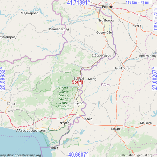
| Upper-left | 41.71891°, | 25.59632° |
| Center: | 41.19194°, | 26.29944° |
| Lower-right: | 40.6607°, | 27.00257° |
| Map W x H: | 117.7×117.7 km | = 73.1×73.1mi |
| max Lat: | 41.72048° ⇑2.5% North |
| Souflí: | 41.19194° |
| min Lat: | ⇓97.5% South 34.8346° |
| min Long | Souflí | max Long |
| 19.40494° | 26.29944° | 29.59361° |
| W 95.6%⇐ | ⇒4.4% E |
Elevation
Elevation of Souflí is 36 m = 118 ft, and this is 132.9 m = 436 ft below average elevation for this country.
| Max E: |
1439 m = 4721 ft | 66.9% |
| Avg. | 168.9 m = 554 ft | |
| Souflí | 36 m = 118 ft | |
Min E: |
0 m = 0 ft | 33.1% |
See also: Greece elevation on elevation.city.
Geographical zone
Souflí is located in North temperate zone (between Tropic of Cancer and the Arctic Circle). Distance of this Northern Tropic circle is 1974.2 km =1226.7 mi to South.| Distance of | km | miles | from Souflí |
|---|---|---|---|
| North Pole | 5426.9 | 3372.1 | to North |
| Arctic Circle | 2821.1 | 1752.9 | to North |
| Tropic Cancer | 1974.2 | 1226.7 | to South |
| Equator | 4580.1 | 2845.9 | to South |


Nearby cities:
15 places around Souflí: (largest is in red/bold)
• Dadía
9.5 km =5.9 mi,  221°
221°
• Didymóteicho
23.9 km =14.9 mi,  43°
43°
• Féres
34.9 km =21.7 mi,  197°
197°
• Karotí
26 km =16.2 mi,  23°
23°
• Koufóvouno
21.5 km =13.4 mi,  32°
32°
• Lagós
31.8 km =19.8 mi, 25°
• Lávara
11.2 km =7 mi, 39°
• Metaxádes
26 km =16.2 mi,  346°
346°
• Neochóri
37.9 km =23.5 mi, 20°
• Néos Pýrgos
37.7 km =23.4 mi, 26°
• Nípsa
37.6 km =23.4 mi, 218°
• Orestiáda
39.6 km =24.6 mi, 29°
• Provatónas
18.7 km =11.6 mi,  190°
190°
• Péplos
26.2 km =16.3 mi, 186°
• Tycheró
18.1 km =11.2 mi,  181°
181°
Sources, notices
• [Note1] Compared only with cities in Greece existing in our database
• [Src1] Map data: © OpenStreetMap contributors (CC-BY-SA)
• [Src2] Other city data from geonames.org with taken over terms of usage.
• [Src3] Geographical zone / Annual Mean Temperature by Robert A. Rohde @ Wikipedia
