Gríva geodata
Gríva (Central Macedonia) is a populated place; located in Greece in Europe/Athens (GMT+3) time zone. With population of 770 people, there are 1305 cities with bigger population in this country. Compared to other cities in Greece, 90.5% of cities are located further ↓South; 62.3% of cities are located further →East and 87.4% of cities have lower elevation than Gríva. Note1


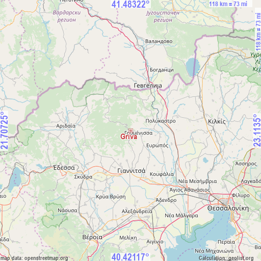
Gríva GPS coordinates[2]
40° 57' 15.588" North, 22° 24' 37.332" East
| Map corner | latitude | longitude |
|---|---|---|
| Upper-left | 41.48322°, | 21.70725° |
| Center: | 40.95433°, | 22.41037° |
| Lower-right: | 40.42117°, | 23.1135° |
| Map W x H: | 118.1×118.1 km | = 73.4×73.4mi |
| max Lat: | 41.72048° ⇑9.5% North |
| Gríva: | 40.95433° |
| min Lat: | ⇓90.5% South 34.8346° |
| min Long | Gríva | max Long |
| 19.40494° | 22.41037° | 29.59361° |
| W 37.7%⇐ | ⇒62.3% E |
Elevation
Elevation of Gríva is 445 m = 1460 ft, and this is 276.1 m = 906 ft above average elevation for this country.
| Max E: |
1439 m = 4721 ft | 12.6% |
| Gríva | 445 m 1460 ft | |
| Avg. | 168.9 m = 554 ft | |
Min E: |
0 m = 0 ft | 87.4% |
See also: Greece elevation on elevation.city.
Geographical zone
Gríva is located in North temperate zone (between Tropic of Cancer and the Arctic Circle). Distance of this Northern Tropic circle is 1947.8 km =1210.3 mi to South.| Distance of | km | miles | from Gríva |
|---|---|---|---|
| North Pole | 5453.4 | 3388.6 | to North |
| Arctic Circle | 2847.5 | 1769.4 | to North |
| Tropic Cancer | 1947.8 | 1210.3 | to South |
| Equator | 4553.7 | 2829.5 | to South |


Nearby cities:
15 places around Gríva: (largest is in red/bold)
• Achladochóri
14.2 km =8.8 mi,  203°
203°
• Ampeleíes
13.5 km =8.4 mi,  188°
188°
• Aravissós
15.3 km =9.5 mi,  216°
216°
• Archángelos
18 km =11.2 mi,  322°
322°
• Axioúpoli
11.6 km =7.2 mi,  72°
72°
• Axós
17.4 km =10.8 mi, 193°
• Evropós
13.6 km =8.5 mi,  118°
118°
• Gorgópi
9.6 km =6 mi,  85°
85°
• Gouménissa
3.4 km =2.1 mi,  105°
105°
• Néos Mylótopos
15.8 km =9.8 mi, 197°
• Pefkodásos
16.8 km =10.4 mi,  56°
56°
• Pentaplátano
15.1 km =9.4 mi,  177°
177°
• Polýkastro
14.1 km =8.8 mi, 71°
• Toúmpa
11.4 km =7.1 mi,  100°
100°
• Ágios Pétros
17.4 km =10.8 mi, 123°
Sources, notices
• [Note1] Compared only with cities in Greece existing in our database
• [Src1] Map data: © OpenStreetMap contributors (CC-BY-SA)
• [Src2] Other city data from geonames.org with taken over terms of usage.
• [Src3] Geographical zone / Annual Mean Temperature by Robert A. Rohde @ Wikipedia
