Ganóchora geodata
Ganóchora (Central Macedonia) is a populated place; located in Greece in Europe/Athens (GMT+3) time zone. With population of 562 people, there are 1671 cities with bigger population in this country. Compared to other cities in Greece, 70.3% of cities are located further ↓South; 60.1% of cities are located further →East and 53.8% of cities have higher elevation than Ganóchora. Note1
Administrative division(s):
- Level 1: Central Macedonia
- Level 2: Nomós Pierías
- Level 3: Dimos Katerini


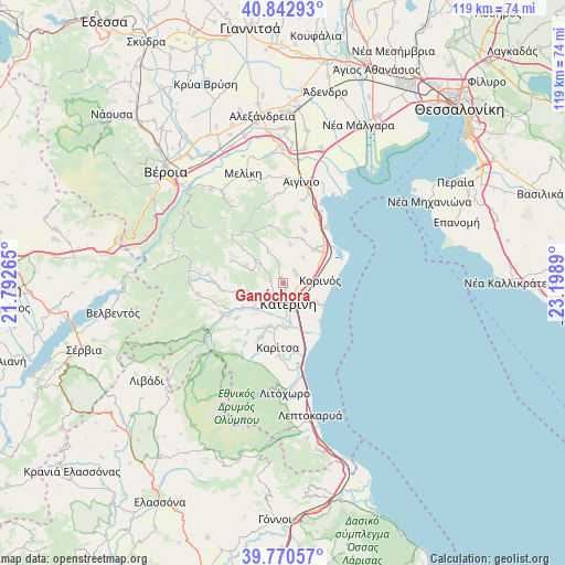
Ganóchora GPS coordinates[2]
40° 18' 31.968" North, 22° 29' 44.772" East
| Map corner | latitude | longitude |
|---|---|---|
| Upper-left | 40.84293°, | 21.79265° |
| Center: | 40.30888°, | 22.49577° |
| Lower-right: | 39.77057°, | 23.1989° |
| Map W x H: | 119.2×119.2 km | = 74.1×74.1mi |
| max Lat: | 41.72048° ⇑29.7% North |
| Ganóchora: | 40.30888° |
| min Lat: | ⇓70.3% South 34.8346° |
| min Long | Ganóchora | max Long |
| 19.40494° | 22.49577° | 29.59361° |
| W 39.9%⇐ | ⇒60.1% E |
Elevation
Elevation of Ganóchora is 68 m = 223 ft, and this is 100.9 m = 331 ft below average elevation for this country.
| Max E: |
1439 m = 4721 ft | 53.8% |
| Avg. | 168.9 m = 554 ft | |
| Ganóchora | 68 m = 223 ft | |
Min E: |
0 m = 0 ft | 46.2% |
See also: Greece elevation on elevation.city.
Geographical zone
Ganóchora is located in North temperate zone (between Tropic of Cancer and the Arctic Circle). Distance of this Northern Tropic circle is 1876 km =1165.7 mi to South.| Distance of | km | miles | from Ganóchora |
|---|---|---|---|
| North Pole | 5525.1 | 3433.1 | to North |
| Arctic Circle | 2919.2 | 1813.9 | to North |
| Tropic Cancer | 1876 | 1165.7 | to South |
| Equator | 4481.9 | 2784.9 | to South |


Nearby cities:
15 places around Ganóchora: (largest is in red/bold)
• Andromáchi
4.2 km =2.6 mi,  197°
197°
• Kallithéa
8 km =5 mi,  119°
119°
• Kateríni
4.5 km =2.8 mi,  168°
168°
• Kontariótissa
9.5 km =5.9 mi, 198°
• Korinós
7.9 km =4.9 mi,  83°
83°
• Káto Ágios Ioánnis
3.3 km =2.1 mi,  52°
52°
• Néa Trapezoúnta
3.7 km =2.3 mi,  40°
40°
• Néa Éfesos
8.9 km =5.5 mi,  178°
178°
• Palaió Keramídi
2.7 km =1.7 mi,  282°
282°
• Paralía
9.7 km =6 mi, 118°
• Perístasi
5.5 km =3.4 mi,  134°
134°
• Sevastí
7 km =4.3 mi, 36°
• Svorónos
5.3 km =3.3 mi,  210°
210°
• Trílofos
7.6 km =4.7 mi,  335°
335°
• Áno Ágios Ioánnis
1.2 km =0.7 mi,  351°
351°
Sources, notices
• [Note1] Compared only with cities in Greece existing in our database
• [Src1] Map data: © OpenStreetMap contributors (CC-BY-SA)
• [Src2] Other city data from geonames.org with taken over terms of usage.
• [Src3] Geographical zone / Annual Mean Temperature by Robert A. Rohde @ Wikipedia
