Néa Trapezoúnta geodata
Néa Trapezoúnta (Central Macedonia) is a populated place; located in Greece in Europe/Athens (GMT+3) time zone. With population of 504 people, there are 1794 cities with bigger population in this country. Compared to other cities in Greece, 71% of cities are located further ↓South; 59.6% of cities are located further →East and 60.5% of cities have lower elevation than Néa Trapezoúnta. Note1
Administrative division(s):
- Level 1: Central Macedonia
- Level 2: Nomós Pierías
- Level 3: Dimos Katerini


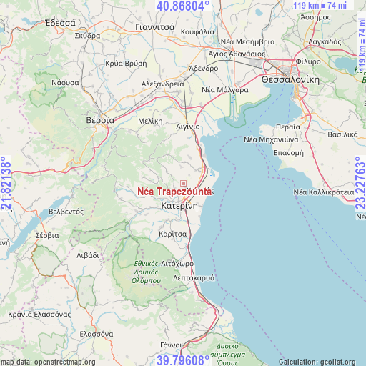
Néa Trapezoúnta GPS coordinates[2]
40° 20' 3.084" North, 22° 31' 28.2" East
| Map corner | latitude | longitude |
|---|---|---|
| Upper-left | 40.86804°, | 21.82138° |
| Center: | 40.33419°, | 22.5245° |
| Lower-right: | 39.79608°, | 23.22763° |
| Map W x H: | 119.2×119.2 km | = 74.1×74.1mi |
| max Lat: | 41.72048° ⇑29% North |
| Néa Trapezoúnta: | 40.33419° |
| min Lat: | ⇓71% South 34.8346° |
| min Long | Néa Trapezoún | max Long |
| 19.40494° | 22.5245° | 29.59361° |
| W 40.4%⇐ | ⇒59.6% E |
Elevation
Elevation of Néa Trapezoúnta is 119 m = 390 ft, and this is 49.9 m = 164 ft below average elevation for this country.
| Max E: |
1439 m = 4721 ft | 39.5% |
| Avg. | 168.9 m = 554 ft | |
| Néa Trapezoúnta | 119 m = 390 ft | |
Min E: |
0 m = 0 ft | 60.5% |
See also: Greece elevation on elevation.city.
Geographical zone
Néa Trapezoúnta is located in North temperate zone (between Tropic of Cancer and the Arctic Circle). Distance of this Northern Tropic circle is 1878.8 km =1167.4 mi to South.| Distance of | km | miles | from Néa Trapezoúnta |
|---|---|---|---|
| North Pole | 5522.3 | 3431.4 | to North |
| Arctic Circle | 2916.4 | 1812.2 | to North |
| Tropic Cancer | 1878.8 | 1167.4 | to South |
| Equator | 4484.7 | 2786.7 | to South |


Nearby cities:
15 places around Néa Trapezoúnta: (largest is in red/bold)
• Alónia
6.8 km =4.2 mi,  11°
11°
• Andromáchi
7.7 km =4.8 mi,  208°
208°
• Ganóchora
3.7 km =2.3 mi,  220°
220°
• Kallithéa
8.1 km =5 mi,  146°
146°
• Kateríni
7.4 km =4.6 mi,  192°
192°
• Korinós
5.7 km =3.5 mi,  109°
109°
• Káto Ágios Ioánnis
0.9 km =0.6 mi,  169°
169°
• Kítros
6.4 km =4 mi,  46°
46°
• Palaió Keramídi
5.6 km =3.5 mi,  246°
246°
• Perístasi
6.8 km =4.2 mi, 167°
• Sevastí
3.3 km =2.1 mi,  32°
32°
• Sfendámi
9 km =5.6 mi, 12°
• Svorónos
9 km =5.6 mi, 215°
• Trílofos
6.9 km =4.3 mi,  306°
306°
• Áno Ágios Ioánnis
3.1 km =1.9 mi,  238°
238°
Sources, notices
• [Note1] Compared only with cities in Greece existing in our database
• [Src1] Map data: © OpenStreetMap contributors (CC-BY-SA)
• [Src2] Other city data from geonames.org with taken over terms of usage.
• [Src3] Geographical zone / Annual Mean Temperature by Robert A. Rohde @ Wikipedia
