Évlalo geodata
Évlalo (East Macedonia and Thrace) is a seat of a third-order administrative division; located in Greece in Europe/Athens (GMT+3) time zone. In our database, there are 1823 cities with bigger population. Compared to other cities in Greece, 91.3% of cities are located further ↓South; 85.6% of cities are located further ←West and 79.3% of cities have higher elevation than Évlalo. Note1
Administrative division(s):
- Level 1: East Macedonia and Thrace
- Level 2: Nomós Xánthis
- Level 3: Dimos Topeiros


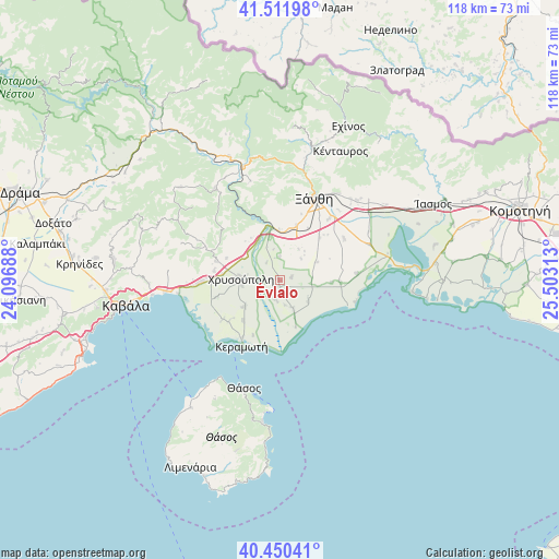
Évlalo GPS coordinates[2]
40° 58' 59.988" North, 24° 48' 0" East
| Map corner | latitude | longitude |
|---|---|---|
| Upper-left | 41.51198°, | 24.09688° |
| Center: | 40.98333°, | 24.8° |
| Lower-right: | 40.45041°, | 25.50313° |
| Map W x H: | 118×118 km | = 73.3×73.3mi |
| max Lat: | 41.72048° ⇑8.7% North |
| Évlalo: | 40.98333° |
| min Lat: | ⇓91.3% South 34.8346° |
| min Long | Évlalo | max Long |
| 19.40494° | 24.8° | 29.59361° |
| W 85.6%⇐ | ⇒14.4% E |
Elevation
Elevation of Évlalo is 18 m = 59 ft, and this is 150.9 m = 495 ft below average elevation for this country.
| Max E: |
1439 m = 4721 ft | 79.3% |
| Avg. | 168.9 m = 554 ft | |
| Évlalo | 18 m = 59 ft | |
Min E: |
0 m = 0 ft | 20.7% |
See also: Greece elevation on elevation.city.
Geographical zone
Évlalo is located in North temperate zone (between Tropic of Cancer and the Arctic Circle). Distance of this Northern Tropic circle is 1951 km =1212.3 mi to South.| Distance of | km | miles | from Évlalo |
|---|---|---|---|
| North Pole | 5450.1 | 3386.5 | to North |
| Arctic Circle | 2844.3 | 1767.4 | to North |
| Tropic Cancer | 1951 | 1212.3 | to South |
| Equator | 4556.9 | 2831.5 | to South |


Nearby cities:
15 places around Évlalo: (largest is in red/bold)
• Agíasma
14.7 km =9.1 mi,  235°
235°
• Chrysochóri
9.3 km =5.8 mi,  233°
233°
• Chrysoúpolis
8.9 km =5.5 mi,  271°
271°
• Erateinó
13.9 km =8.6 mi,  254°
254°
• Genisséa
16.2 km =10.1 mi,  57°
57°
• Gravoúna
12.4 km =7.7 mi,  276°
276°
• Iliokentima
3.9 km =2.4 mi,  194°
194°
• Néa Karyá
11.6 km =7.2 mi,  222°
222°
• Peteinós
15.4 km =9.6 mi,  32°
32°
• Petrochóri
12.1 km =7.5 mi,  16°
16°
• Petropigí
15.5 km =9.6 mi, 271°
• Pigés
13.8 km =8.6 mi, 231°
• Pérni
13.9 km =8.6 mi, 277°
• Zarkadiá
13.9 km =8.6 mi,  286°
286°
• Ávato
2.3 km =1.4 mi,  170°
170°
Sources, notices
• [Note1] Compared only with cities in Greece existing in our database
• [Src1] Map data: © OpenStreetMap contributors (CC-BY-SA)
• [Src2] Other city data from geonames.org with taken over terms of usage.
• [Src3] Geographical zone / Annual Mean Temperature by Robert A. Rohde @ Wikipedia
