Chalan Pago-Ordot Village geodata
Chalan Pago-Ordot Village (Chalan Pago-Ordot) is a seat of a first-order administrative division; located in Guam in Pacific/Guam (GMT+10) time zone. With population of 6,822 people, there are 8 cities with bigger population in this country. Compared to other cities in Guam, 66.7% of cities are located further ↑North; 61.9% of cities are located further ←West and 52.4% of cities have lower elevation than Chalan Pago-Ordot Village. Note1
Current local time in Chalan Pago-Ordot Village:
09:14 AM, WednesdayDifference from your time zone: hours


Chalan Pago-Ordot Village GPS coordinates[2]
13° 26' 50.676" North, 144° 45' 32.472" East
| Map corner | latitude | longitude |
|---|---|---|
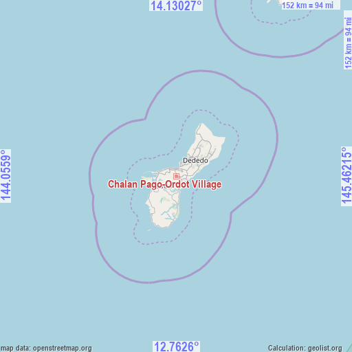
| Upper-left | 14.13027°, | 144.0559° |
| Center: | 13.44741°, | 144.75902° |
| Lower-right: | 12.7626°, | 145.46215° |
| Map W x H: | 152.1×152.1 km | = 94.5×94.5mi |
| max Lat: | 13.53605° ⇑66.7% North |
| Chalan Pago-Ordot Village: | 13.44741° |
| min Lat: | ⇓33.3% South 13.26584° |
| min Long | Chalan Pago-Ord | max Long |
| 144.65852° | 144.75902° | 144.88855° |
| W 61.9%⇐ | ⇒38.1% E |
Elevation
Elevation of Chalan Pago-Ordot Village is 46 m = 151 ft, and this is 2.8 m = 9 ft above average elevation for this country.
| Max E: |
132 m = 433 ft | 47.6% |
| Chalan Pago-Ordot Village | 46 m 151 ft | |
| Avg. | 43.2 m = 142 ft | |
Min E: |
0 m = 0 ft | 52.4% |
See also: Guam elevation on elevation.city.
Geographical zone
Chalan Pago-Ordot Village is located in North Torrid zone (between Equator and Tropic of Cancer). Distance of this Northern Tropic circle is 1110.7 km =690.2 mi to North.| Distance of | km | miles | from Chalan Pago-Ordot Village |
|---|---|---|---|
| North Pole | 8511.9 | 5289 | to North |
| Arctic Circle | 5906 | 3669.8 | to North |
| Tropic Cancer | 1110.7 | 690.2 | to North |
| Equator | 1495.2 | 929.1 | to South |


Nearby cities:
15 places around Chalan Pago-Ordot Village: (largest is in red/bold)
• Agana Heights Village
2.3 km =1.4 mi,  329°
329°
• Asan-Maina Village
5.4 km =3.4 mi,  300°
300°
• Barrigada Village
5 km =3.1 mi,  60°
60°
• Guam Government House
2.9 km =1.8 mi,  339°
339°
• Hagåtña
3.3 km =2.1 mi, 340°
• Hagåtña Village
2.8 km =1.7 mi,  357°
357°
• Mangilao Village
4.5 km =2.8 mi,  89°
89°
• Mongmong-Toto-Maite Village
3.4 km =2.1 mi,  46°
46°
• Piti Village
7.3 km =4.5 mi,  283°
283°
• Santa Rita Village
11.6 km =7.2 mi,  233°
233°
• Sinajana Village
1.9 km =1.2 mi, 343°
• Talofofo Village
10.3 km =6.4 mi,  180°
180°
• Tamuning
5.1 km =3.2 mi,  28°
28°
• Tamuning-Tumon-Harmon Village
5.1 km =3.2 mi, 28°
• Yona Village
4.6 km =2.9 mi,  155°
155°
Sources, notices
• [Note1] Compared only with cities in Guam existing in our database
• [Src1] Map data: © OpenStreetMap contributors (CC-BY-SA)
• [Src2] Other city data from geonames.org with taken over terms of usage.
• [Src3] Geographical zone / Annual Mean Temperature by Robert A. Rohde @ Wikipedia
