Hagåtña geodata
Hagåtña (Hagatna) is a capital of a political entity; located in Guam in Pacific/Guam (GMT+10) time zone. With population of 1,051 people, there are 18 cities with bigger population in this country. Compared to other cities in Guam, 81% of cities are located further ↓South; 61.9% of cities are located further →East and 95.2% of cities have higher elevation than Hagåtña. Note1


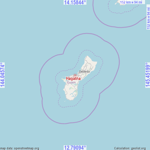
Hagåtña GPS coordinates[2]
13° 28' 32.412" North, 144° 44' 55.896" East
| Map corner | latitude | longitude |
|---|---|---|
| Upper-left | 14.15844°, | 144.04574° |
| Center: | 13.47567°, | 144.74886° |
| Lower-right: | 12.79094°, | 145.45199° |
| Map W x H: | 152.1×152.1 km | = 94.5×94.5mi |
| max Lat: | 13.53605° ⇑19% North |
| Hagåtña: | 13.47567° |
| min Lat: | ⇓81% South 13.26584° |
| min Long | Hagåtña | max Long |
| 144.65852° | 144.74886° | 144.88855° |
| W 38.1%⇐ | ⇒61.9% E |
Elevation
Elevation of Hagåtña is 5 m = 16 ft, and this is 38.2 m = 125 ft below average elevation for this country.
| Max E: |
132 m = 433 ft | 95.2% |
| Avg. | 43.2 m = 142 ft | |
| Hagåtña | 5 m = 16 ft | |
Min E: |
0 m = 0 ft | 4.8% |
See also: Guam elevation on elevation.city.
Geographical zone
Hagåtña is located in North Torrid zone (between Equator and Tropic of Cancer). Distance of this Northern Tropic circle is 1107.6 km =688.2 mi to North.| Distance of | km | miles | from Hagåtña |
|---|---|---|---|
| North Pole | 8508.7 | 5287.1 | to North |
| Arctic Circle | 5902.8 | 3667.8 | to North |
| Tropic Cancer | 1107.6 | 688.2 | to North |
| Equator | 1498.4 | 931.1 | to South |


Nearby cities:
15 places around Hagåtña: (largest is in red/bold)
• Agana Heights Village
1.1 km =0.7 mi,  185°
185°
• Asan-Maina Village
3.5 km =2.2 mi,  263°
263°
• Barrigada Village
5.5 km =3.4 mi,  97°
97°
• Chalan Pago-Ordot Village
3.3 km =2.1 mi,  160°
160°
• Dededo Village
10.8 km =6.7 mi,  64°
64°
• Guam Government House
0.4 km =0.2 mi,  166°
166°
• Hagåtña Village
1 km =0.6 mi,  107°
107°
• Mangilao Village
6.5 km =4 mi,  118°
118°
• Mongmong-Toto-Maite Village
3.7 km =2.3 mi, 102°
• Piti Village
6.2 km =3.9 mi, 256°
• Santa Rita Village
13 km =8.1 mi,  219°
219°
• Sinajana Village
1.5 km =0.9 mi, 157°
• Tamuning
3.8 km =2.4 mi,  69°
69°
• Tamuning-Tumon-Harmon Village
3.8 km =2.4 mi, 69°
• Yona Village
7.9 km =4.9 mi, 157°
Sources, notices
• [Note1] Compared only with cities in Guam existing in our database
• [Src1] Map data: © OpenStreetMap contributors (CC-BY-SA)
• [Src2] Other city data from geonames.org with taken over terms of usage.
• [Src3] Geographical zone / Annual Mean Temperature by Robert A. Rohde @ Wikipedia
