Vrgorac geodata
Vrgorac (Split-Dalmatia) is a populated place; located in Croatia in Europe/Zagreb (GMT+2) time zone. With population of 2,199 people, there are 190 cities with bigger population in this country. Compared to other cities in Croatia, 95.6% of cities are located further ↑North; 73.9% of cities are located further ←West and 83.9% of cities have lower elevation than Vrgorac. Note1


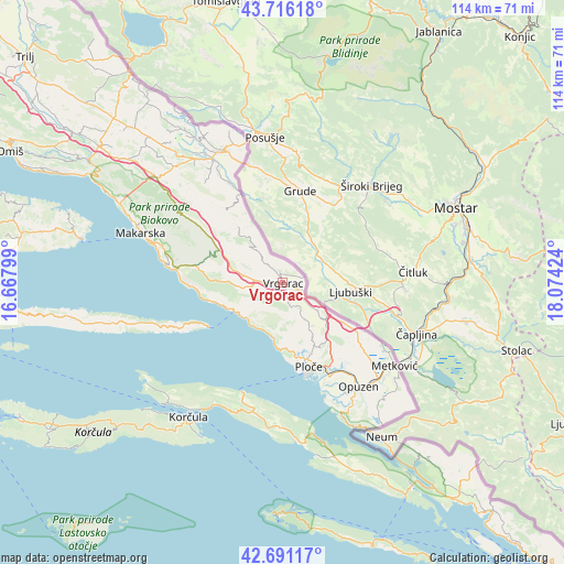
Vrgorac GPS coordinates[2]
43° 12' 20.988" North, 17° 22' 15.996" East
| Map corner | latitude | longitude |
|---|---|---|
| Upper-left | 43.71618°, | 16.66799° |
| Center: | 43.20583°, | 17.37111° |
| Lower-right: | 42.69117°, | 18.07424° |
| Map W x H: | 114×114 km | = 70.8×70.8mi |
| max Lat: | 46.52694° ⇑95.6% North |
| Vrgorac: | 43.20583° |
| min Lat: | ⇓4.4% South 42.54972° |
| min Long | Vrgorac | max Long |
| 13.52389° | 17.37111° | 19.37694° |
| W 73.9%⇐ | ⇒26.1% E |
Elevation
Elevation of Vrgorac is 230 m = 755 ft, and this is 76.7 m = 252 ft above average elevation for this country.
| Max E: |
827 m = 2713 ft | 16.1% |
| Vrgorac | 230 m 755 ft | |
| Avg. | 153.3 m = 503 ft | |
Min E: |
-1 m = -3 ft | 83.9% |
See also: Croatia elevation on elevation.city.
Geographical zone
Vrgorac is located in North temperate zone (between Tropic of Cancer and the Arctic Circle). Distance of this Northern Tropic circle is 2198.1 km =1365.8 mi to South.| Distance of | km | miles | from Vrgorac |
|---|---|---|---|
| North Pole | 5203 | 3233 | to North |
| Arctic Circle | 2597.1 | 1613.8 | to North |
| Tropic Cancer | 2198.1 | 1365.8 | to South |
| Equator | 4804 | 2985.1 | to South |


Nearby cities:
15 places around Vrgorac: (largest is in red/bold)
• Gradac
11.4 km =7.1 mi,  192°
192°
• Komin
22.8 km =14.2 mi,  143°
143°
• Kraj
10.5 km =6.5 mi,  226°
226°
• Opuzen
26.4 km =16.4 mi, 143°
• Otrić-Seoci
8.3 km =5.2 mi,  129°
129°
• Ploče
17.4 km =10.8 mi,  163°
163°
• Podbablje
26 km =16.2 mi,  323°
323°
• Podgora
24.2 km =15 mi,  279°
279°
• Rogotin
19.5 km =12.1 mi,  153°
153°
• Runović
21.9 km =13.6 mi,  330°
330°
• Staševica
8.7 km =5.4 mi, 149°
• Sućuraj
17.5 km =10.9 mi,  239°
239°
• Trpanj
23.4 km =14.5 mi,  199°
199°
• Vlaka
26.1 km =16.2 mi, 151°
• Zmijavci
26.4 km =16.4 mi, 329°
Sources, notices
• [Note1] Compared only with cities in Croatia existing in our database
• [Src1] Map data: © OpenStreetMap contributors (CC-BY-SA)
• [Src2] Other city data from geonames.org with taken over terms of usage.
• [Src3] Geographical zone / Annual Mean Temperature by Robert A. Rohde @ Wikipedia
