Srebreno geodata
Srebreno (Dubrovačko-Neretvanska) is a seat of a second-order administrative division; located in Croatia in Europe/Zagreb (GMT+2) time zone. In our database, there are 904 cities with bigger population. Compared to other cities in Croatia, 99.5% of cities are located further ↑North; 85% of cities are located further ←West and 94.3% of cities have higher elevation than Srebreno. Note1


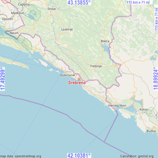
Srebreno GPS coordinates[2]
42° 37' 23.988" North, 18° 11' 45.996" East
| Map corner | latitude | longitude |
|---|---|---|
| Upper-left | 43.13855°, | 17.49299° |
| Center: | 42.62333°, | 18.19611° |
| Lower-right: | 42.10381°, | 18.89924° |
| Map W x H: | 115.1×115.1 km | = 71.5×71.5mi |
| max Lat: | 46.52694° ⇑99.5% North |
| Srebreno: | 42.62333° |
| min Lat: | ⇓0.5% South 42.54972° |
| min Long | Srebreno | max Long |
| 13.52389° | 18.19611° | 19.37694° |
| W 85%⇐ | ⇒15% E |
Elevation
Elevation of Srebreno is 11 m = 36 ft, and this is 142.3 m = 467 ft below average elevation for this country.
| Max E: |
827 m = 2713 ft | 94.3% |
| Avg. | 153.3 m = 503 ft | |
| Srebreno | 11 m = 36 ft | |
Min E: |
-1 m = -3 ft | 5.7% |
See also: Croatia elevation on elevation.city.
Geographical zone
Srebreno is located in North temperate zone (between Tropic of Cancer and the Arctic Circle). Distance of this Northern Tropic circle is 2133.4 km =1325.6 mi to South.| Distance of | km | miles | from Srebreno |
|---|---|---|---|
| North Pole | 5267.8 | 3273.3 | to North |
| Arctic Circle | 2661.9 | 1654 | to North |
| Tropic Cancer | 2133.4 | 1325.6 | to South |
| Equator | 4739.3 | 2944.9 | to South |


Nearby cities:
15 places around Srebreno: (largest is in red/bold)
• Brašina
0.4 km =0.2 mi,  26°
26°
• Cavtat
5 km =3.1 mi,  159°
159°
• Dubrovnik
8.9 km =5.5 mi,  287°
287°
• Kupari
0.5 km =0.3 mi,  228°
228°
• Mlini
0.9 km =0.6 mi,  91°
91°
• Mokošica
10.4 km =6.5 mi,  303°
303°
• Orašac
17.7 km =11 mi, 299°
• Petrača
1 km =0.6 mi,  346°
346°
• Podgora
38.6 km =24 mi,  310°
310°
• Slano
30.7 km =19.1 mi, 306°
• Zaton
14.9 km =9.3 mi, 300°
• Zaton Doli
43.2 km =26.8 mi, 302°
• Zvekovica
6.3 km =3.9 mi,  145°
145°
• Čibača
2.1 km =1.3 mi, 286°
• Čilipi
10.9 km =6.8 mi,  138°
138°
Sources, notices
• [Note1] Compared only with cities in Croatia existing in our database
• [Src1] Map data: © OpenStreetMap contributors (CC-BY-SA)
• [Src2] Other city data from geonames.org with taken over terms of usage.
• [Src3] Geographical zone / Annual Mean Temperature by Robert A. Rohde @ Wikipedia
