Šiljakovina geodata
Šiljakovina (Zagrebačka) is a populated place; located in Croatia in Europe/Zagreb (GMT+2) time zone. With population of 672 people, there are 692 cities with bigger population in this country. Compared to other cities in Croatia, 60.5% of cities are located further ↓South; 68.6% of cities are located further →East and 63.4% of cities have lower elevation than Šiljakovina. Note1


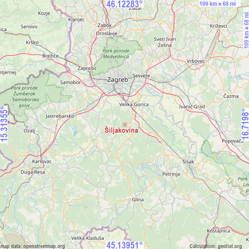
Šiljakovina GPS coordinates[2]
45° 37' 59.988" North, 16° 1' 0.012" East
| Map corner | latitude | longitude |
|---|---|---|
| Upper-left | 46.12283°, | 15.31355° |
| Center: | 45.63333°, | 16.01667° |
| Lower-right: | 45.13951°, | 16.7198° |
| Map W x H: | 109.3×109.3 km | = 67.9×67.9mi |
| max Lat: | 46.52694° ⇑39.5% North |
| Šiljakovina: | 45.63333° |
| min Lat: | ⇓60.5% South 42.54972° |
| min Long | Šiljakovina | max Long |
| 13.52389° | 16.01667° | 19.37694° |
| W 31.4%⇐ | ⇒68.6% E |
Elevation
Elevation of Šiljakovina is 152 m = 499 ft, and this is 1.3 m = 4 ft below average elevation for this country.
| Max E: |
827 m = 2713 ft | 36.6% |
| Avg. | 153.3 m = 503 ft | |
| Šiljakovina | 152 m = 499 ft | |
Min E: |
-1 m = -3 ft | 63.4% |
See also: Croatia elevation on elevation.city.
Geographical zone
Šiljakovina is located in North temperate zone (between Tropic of Cancer and the Arctic Circle). Distance of this North polar circle is 2327.2 km =1446.1 mi to North.| Distance of | km | miles | from Šiljakovina |
|---|---|---|---|
| North Pole | 4933.1 | 3065.3 | to North |
| Arctic Circle | 2327.2 | 1446.1 | to North |
| Tropic Cancer | 2468 | 1533.5 | to South |
| Equator | 5074 | 3152.8 | to South |


Nearby cities:
15 places around Šiljakovina: (largest is in red/bold)
• Buševec
8 km =5 mi,  89°
89°
• Donja Lomnica
8.8 km =5.5 mi,  5°
5°
• Gornja Lomnica
9.4 km =5.8 mi,  352°
352°
• Gradići
7.9 km =4.9 mi,  19°
19°
• Kravarsko
6.1 km =3.8 mi,  154°
154°
• Lukavec
8.2 km =5.1 mi, 345°
• Mraclin
7.2 km =4.5 mi,  58°
58°
• Novo Čiče
10.7 km =6.6 mi,  46°
46°
• Odra
10.9 km =6.8 mi, 350°
• Petrovina Turopoljska
7.5 km =4.7 mi, 9°
• Staro Čiče
10.7 km =6.6 mi, 46°
• Turopolje
10 km =6.2 mi,  79°
79°
• Velika Buna
3.9 km =2.4 mi, 90°
• Velika Gorica
9.9 km =6.2 mi,  27°
27°
• Vukovina
9.6 km =6 mi, 54°
Sources, notices
• [Note1] Compared only with cities in Croatia existing in our database
• [Src1] Map data: © OpenStreetMap contributors (CC-BY-SA)
• [Src2] Other city data from geonames.org with taken over terms of usage.
• [Src3] Geographical zone / Annual Mean Temperature by Robert A. Rohde @ Wikipedia
