Buševec geodata
Buševec (Zagrebačka) is a populated place; located in Croatia in Europe/Zagreb (GMT+2) time zone. With population of 886 people, there are 535 cities with bigger population in this country. Compared to other cities in Croatia, 60.6% of cities are located further ↓South; 64.5% of cities are located further →East and 62.4% of cities have higher elevation than Buševec. Note1


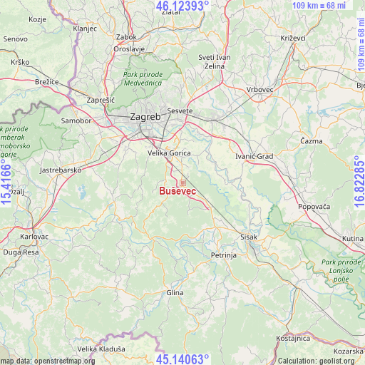
Buševec GPS coordinates[2]
45° 38' 3.984" North, 16° 7' 10.992" East
| Map corner | latitude | longitude |
|---|---|---|
| Upper-left | 46.12393°, | 15.4166° |
| Center: | 45.63444°, | 16.11972° |
| Lower-right: | 45.14063°, | 16.82285° |
| Map W x H: | 109.3×109.3 km | = 67.9×67.9mi |
| max Lat: | 46.52694° ⇑39.4% North |
| Buševec: | 45.63444° |
| min Lat: | ⇓60.6% South 42.54972° |
| min Long | Buševec | max Long |
| 13.52389° | 16.11972° | 19.37694° |
| W 35.5%⇐ | ⇒64.5% E |
Elevation
Elevation of Buševec is 106 m = 348 ft, and this is 47.3 m = 155 ft below average elevation for this country.
| Max E: |
827 m = 2713 ft | 62.4% |
| Avg. | 153.3 m = 503 ft | |
| Buševec | 106 m = 348 ft | |
Min E: |
-1 m = -3 ft | 37.6% |
See also: Croatia elevation on elevation.city.
Geographical zone
Buševec is located in North temperate zone (between Tropic of Cancer and the Arctic Circle). Distance of this North polar circle is 2327.1 km =1446 mi to North.| Distance of | km | miles | from Buševec |
|---|---|---|---|
| North Pole | 4933 | 3065.2 | to North |
| Arctic Circle | 2327.1 | 1446 | to North |
| Tropic Cancer | 2468.2 | 1533.7 | to South |
| Equator | 5074.1 | 3152.9 | to South |


Nearby cities:
15 places around Buševec: (largest is in red/bold)
• Gradići
9.1 km =5.7 mi,  323°
323°
• Jagodno
7.7 km =4.8 mi,  17°
17°
• Kravarsko
7.9 km =4.9 mi,  223°
223°
• Kuče
5.1 km =3.2 mi, 22°
• Lekenik
9 km =5.6 mi,  127°
127°
• Mraclin
4 km =2.5 mi,  332°
332°
• Novo Čiče
7.3 km =4.5 mi,  358°
358°
• Poljana Čička
7.2 km =4.5 mi,  40°
40°
• Rakitovec
4.3 km =2.7 mi,  33°
33°
• Ribnica
9.2 km =5.7 mi,  6°
6°
• Staro Čiče
7.3 km =4.5 mi, 358°
• Turopolje
2.5 km =1.6 mi,  48°
48°
• Velika Buna
4.1 km =2.5 mi,  268°
268°
• Vukovina
5.4 km =3.4 mi, 357°
• Šiljakovina
8 km =5 mi, 269°
Sources, notices
• [Note1] Compared only with cities in Croatia existing in our database
• [Src1] Map data: © OpenStreetMap contributors (CC-BY-SA)
• [Src2] Other city data from geonames.org with taken over terms of usage.
• [Src3] Geographical zone / Annual Mean Temperature by Robert A. Rohde @ Wikipedia
