Predavac geodata
Predavac (Bjelovarsko-Bilogorska) is a populated place; located in Croatia in Europe/Zagreb (GMT+2) time zone. With population of 1,254 people, there are 359 cities with bigger population in this country. Compared to other cities in Croatia, 79.5% of cities are located further ↓South; 62.3% of cities are located further ←West and 52.9% of cities have higher elevation than Predavac. Note1


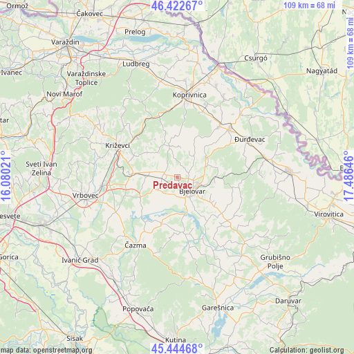
Predavac GPS coordinates[2]
45° 56' 8.988" North, 16° 46' 59.988" East
| Map corner | latitude | longitude |
|---|---|---|
| Upper-left | 46.42267°, | 16.08021° |
| Center: | 45.93583°, | 16.78333° |
| Lower-right: | 45.44468°, | 17.48646° |
| Map W x H: | 108.7×108.7 km | = 67.5×67.5mi |
| max Lat: | 46.52694° ⇑20.5% North |
| Predavac: | 45.93583° |
| min Lat: | ⇓79.5% South 42.54972° |
| min Long | Predavac | max Long |
| 13.52389° | 16.78333° | 19.37694° |
| W 62.3%⇐ | ⇒37.7% E |
Elevation
Elevation of Predavac is 121 m = 397 ft, and this is 32.3 m = 106 ft below average elevation for this country.
| Max E: |
827 m = 2713 ft | 52.9% |
| Avg. | 153.3 m = 503 ft | |
| Predavac | 121 m = 397 ft | |
Min E: |
-1 m = -3 ft | 47.1% |
See also: Croatia elevation on elevation.city.
Geographical zone
Predavac is located in North temperate zone (between Tropic of Cancer and the Arctic Circle). Distance of this North polar circle is 2293.6 km =1425.2 mi to North.| Distance of | km | miles | from Predavac |
|---|---|---|---|
| North Pole | 4899.5 | 3044.4 | to North |
| Arctic Circle | 2293.6 | 1425.2 | to North |
| Tropic Cancer | 2501.7 | 1554.5 | to South |
| Equator | 5107.6 | 3173.7 | to South |


Nearby cities:
15 places around Predavac: (largest is in red/bold)
• Bjelovar
6.5 km =4 mi,  129°
129°
• Brezovac
8.8 km =5.5 mi,  149°
149°
• Cirkvena
9.5 km =5.9 mi,  267°
267°
• Gornje Plavnice
6.5 km =4 mi,  92°
92°
• Gudovac
6.2 km =3.9 mi,  181°
181°
• Kapela
7.9 km =4.9 mi,  42°
42°
• Klokočevac
2.1 km =1.3 mi, 180°
• Narta
11.5 km =7.1 mi, 178°
• Novoseljani
9.7 km =6 mi, 127°
• Prgomelje
5.6 km =3.5 mi,  205°
205°
• Rovišće
3.9 km =2.4 mi,  284°
284°
• Stare Plavnice
4.7 km =2.9 mi, 147°
• Veliko Korenovo
9.6 km =6 mi,  172°
172°
• Veliko Trojstvo
11.7 km =7.3 mi, 90°
• Ždralovi
9.7 km =6 mi, 132°
Sources, notices
• [Note1] Compared only with cities in Croatia existing in our database
• [Src1] Map data: © OpenStreetMap contributors (CC-BY-SA)
• [Src2] Other city data from geonames.org with taken over terms of usage.
• [Src3] Geographical zone / Annual Mean Temperature by Robert A. Rohde @ Wikipedia
