Rovišće geodata
Rovišće (Bjelovarsko-Bilogorska) is a seat of a second-order administrative division; located in Croatia in Europe/Zagreb (GMT+2) time zone. With population of 1,278 people, there are 350 cities with bigger population in this country. Compared to other cities in Croatia, 79.7% of cities are located further ↓South; 61.4% of cities are located further ←West and 50.5% of cities have lower elevation than Rovišće. Note1


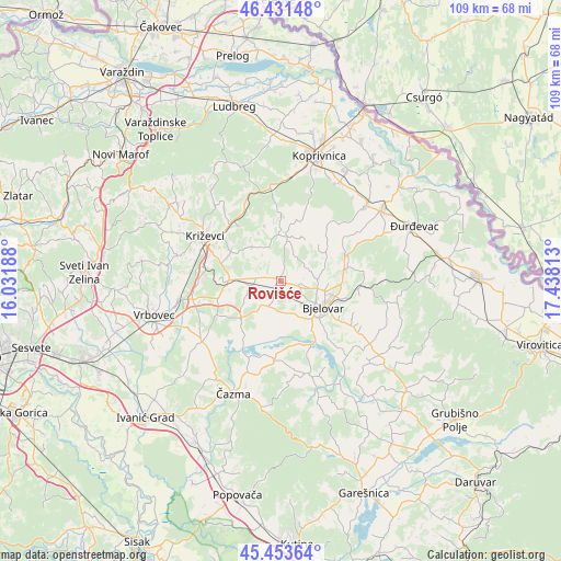
Rovišće GPS coordinates[2]
45° 56' 40.992" North, 16° 44' 6" East
| Map corner | latitude | longitude |
|---|---|---|
| Upper-left | 46.43148°, | 16.03188° |
| Center: | 45.94472°, | 16.735° |
| Lower-right: | 45.45364°, | 17.43813° |
| Map W x H: | 108.7×108.7 km | = 67.5×67.5mi |
| max Lat: | 46.52694° ⇑20.3% North |
| Rovišće: | 45.94472° |
| min Lat: | ⇓79.7% South 42.54972° |
| min Long | Rovišće | max Long |
| 13.52389° | 16.735° | 19.37694° |
| W 61.4%⇐ | ⇒38.6% E |
Elevation
Elevation of Rovišće is 128 m = 420 ft, and this is 25.3 m = 83 ft below average elevation for this country.
| Max E: |
827 m = 2713 ft | 49.5% |
| Avg. | 153.3 m = 503 ft | |
| Rovišće | 128 m = 420 ft | |
Min E: |
-1 m = -3 ft | 50.5% |
See also: Croatia elevation on elevation.city.
Geographical zone
Rovišće is located in North temperate zone (between Tropic of Cancer and the Arctic Circle). Distance of this North polar circle is 2292.6 km =1424.6 mi to North.| Distance of | km | miles | from Rovišće |
|---|---|---|---|
| North Pole | 4898.5 | 3043.8 | to North |
| Arctic Circle | 2292.6 | 1424.6 | to North |
| Tropic Cancer | 2502.7 | 1555.1 | to South |
| Equator | 5108.6 | 3174.3 | to South |


Nearby cities:
15 places around Rovišće: (largest is in red/bold)
• Bjelovar
10.2 km =6.3 mi,  120°
120°
• Brezovac
11.9 km =7.4 mi,  136°
136°
• Cirkvena
5.9 km =3.7 mi,  255°
255°
• Farkaševac
10.3 km =6.4 mi,  225°
225°
• Gornje Plavnice
10.3 km =6.4 mi,  97°
97°
• Gudovac
8 km =5 mi,  153°
153°
• Kapela
10.2 km =6.3 mi,  61°
61°
• Klokočevac
4.9 km =3 mi,  129°
129°
• Predavac
3.9 km =2.4 mi, 104°
• Prgomelje
6.1 km =3.8 mi,  167°
167°
• Stare Plavnice
8 km =5 mi, 128°
• Sveti Ivan Žabno
9.4 km =5.8 mi,  270°
270°
• Sveti Petar Čvrstec
8.4 km =5.2 mi,  319°
319°
• Trema
11.3 km =7 mi,  293°
293°
• Veliko Korenovo
11.7 km =7.3 mi, 154°
Sources, notices
• [Note1] Compared only with cities in Croatia existing in our database
• [Src1] Map data: © OpenStreetMap contributors (CC-BY-SA)
• [Src2] Other city data from geonames.org with taken over terms of usage.
• [Src3] Geographical zone / Annual Mean Temperature by Robert A. Rohde @ Wikipedia
