Prgomelje geodata
Prgomelje (Bjelovarsko-Bilogorska) is a populated place; located in Croatia in Europe/Zagreb (GMT+2) time zone. With population of 696 people, there are 669 cities with bigger population in this country. Compared to other cities in Croatia, 76.9% of cities are located further ↓South; 61.8% of cities are located further ←West and 58.9% of cities have higher elevation than Prgomelje. Note1


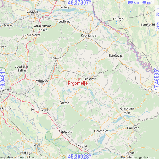
Prgomelje GPS coordinates[2]
45° 53' 26.988" North, 16° 45' 7.992" East
| Map corner | latitude | longitude |
|---|---|---|
| Upper-left | 46.37807°, | 16.0491° |
| Center: | 45.89083°, | 16.75222° |
| Lower-right: | 45.39928°, | 17.45535° |
| Map W x H: | 108.8×108.8 km | = 67.6×67.6mi |
| max Lat: | 46.52694° ⇑23.1% North |
| Prgomelje: | 45.89083° |
| min Lat: | ⇓76.9% South 42.54972° |
| min Long | Prgomelje | max Long |
| 13.52389° | 16.75222° | 19.37694° |
| W 61.8%⇐ | ⇒38.2% E |
Elevation
Elevation of Prgomelje is 111 m = 364 ft, and this is 42.3 m = 139 ft below average elevation for this country.
| Max E: |
827 m = 2713 ft | 58.9% |
| Avg. | 153.3 m = 503 ft | |
| Prgomelje | 111 m = 364 ft | |
Min E: |
-1 m = -3 ft | 41.1% |
See also: Croatia elevation on elevation.city.
Geographical zone
Prgomelje is located in North temperate zone (between Tropic of Cancer and the Arctic Circle). Distance of this North polar circle is 2298.6 km =1428.3 mi to North.| Distance of | km | miles | from Prgomelje |
|---|---|---|---|
| North Pole | 4904.5 | 3047.5 | to North |
| Arctic Circle | 2298.6 | 1428.3 | to North |
| Tropic Cancer | 2496.7 | 1551.4 | to South |
| Equator | 5102.6 | 3170.6 | to South |


Nearby cities:
15 places around Prgomelje: (largest is in red/bold)
• Bjelovar
7.5 km =4.7 mi,  83°
83°
• Brezovac
7.3 km =4.5 mi,  110°
110°
• Cirkvena
8.4 km =5.2 mi,  302°
302°
• Farkaševac
8.7 km =5.4 mi,  261°
261°
• Gornje Plavnice
10 km =6.2 mi,  61°
61°
• Gudovac
2.5 km =1.6 mi,  117°
117°
• Klokočevac
3.7 km =2.3 mi,  39°
39°
• Narta
7 km =4.3 mi,  157°
157°
• Novoseljani
10.2 km =6.3 mi,  94°
94°
• Predavac
5.6 km =3.5 mi,  25°
25°
• Rovišće
6.1 km =3.8 mi,  347°
347°
• Stare Plavnice
5.1 km =3.2 mi, 78°
• Veliko Korenovo
5.9 km =3.7 mi,  140°
140°
• Štefanje
9.9 km =6.2 mi,  194°
194°
• Ždralovi
9.6 km =6 mi,  99°
99°
Sources, notices
• [Note1] Compared only with cities in Croatia existing in our database
• [Src1] Map data: © OpenStreetMap contributors (CC-BY-SA)
• [Src2] Other city data from geonames.org with taken over terms of usage.
• [Src3] Geographical zone / Annual Mean Temperature by Robert A. Rohde @ Wikipedia
