Poljanec geodata
Poljanec (Varaždinska) is a populated place; located in Croatia in Europe/Zagreb (GMT+2) time zone. With population of 716 people, there are 651 cities with bigger population in this country. Compared to other cities in Croatia, 91.5% of cities are located further ↓South; 54.9% of cities are located further ←West and 62.9% of cities have lower elevation than Poljanec. Note1


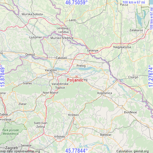
Poljanec GPS coordinates[2]
46° 16' 0.012" North, 16° 34' 24.996" East
| Map corner | latitude | longitude |
|---|---|---|
| Upper-left | 46.75059°, | 15.87049° |
| Center: | 46.26667°, | 16.57361° |
| Lower-right: | 45.77844°, | 17.27674° |
| Map W x H: | 108.1×108.1 km | = 67.2×67.2mi |
| max Lat: | 46.52694° ⇑8.5% North |
| Poljanec: | 46.26667° |
| min Lat: | ⇓91.5% South 42.54972° |
| min Long | Poljanec | max Long |
| 13.52389° | 16.57361° | 19.37694° |
| W 54.9%⇐ | ⇒45.1% E |
Elevation
Elevation of Poljanec is 151 m = 495 ft, and this is 2.3 m = 8 ft below average elevation for this country.
| Max E: |
827 m = 2713 ft | 37.1% |
| Avg. | 153.3 m = 503 ft | |
| Poljanec | 151 m = 495 ft | |
Min E: |
-1 m = -3 ft | 62.9% |
See also: Croatia elevation on elevation.city.
Geographical zone
Poljanec is located in North temperate zone (between Tropic of Cancer and the Arctic Circle). Distance of this North polar circle is 2256.8 km =1402.3 mi to North.| Distance of | km | miles | from Poljanec |
|---|---|---|---|
| North Pole | 4862.7 | 3021.5 | to North |
| Arctic Circle | 2256.8 | 1402.3 | to North |
| Tropic Cancer | 2538.5 | 1577.4 | to South |
| Equator | 5144.4 | 3196.6 | to South |


Nearby cities:
15 places around Poljanec: (largest is in red/bold)
• Hrastovsko
2.1 km =1.3 mi,  156°
156°
• Hrženica
3.6 km =2.2 mi,  1°
1°
• Jalžabet
7.6 km =4.7 mi,  265°
265°
• Karlovec Ludbreški
5.1 km =3.2 mi,  56°
56°
• Ludbreg
3.6 km =2.2 mi,  117°
117°
• Martijanec
2.6 km =1.6 mi, 267°
• Podbrest
7.5 km =4.7 mi,  342°
342°
• Prelog
8.3 km =5.2 mi,  22°
22°
• Selnik
2.8 km =1.7 mi,  86°
86°
• Sigetec Ludbreški
5.1 km =3.2 mi,  99°
99°
• Slanje
4.5 km =2.8 mi,  210°
210°
• Sveti Ðurđ
3.1 km =1.9 mi,  49°
49°
• Vinogradi Ludbreški
3.8 km =2.4 mi,  168°
168°
• Vrbanovec
4.1 km =2.5 mi, 267°
• Šemovec
8.9 km =5.5 mi,  297°
297°
Sources, notices
• [Note1] Compared only with cities in Croatia existing in our database
• [Src1] Map data: © OpenStreetMap contributors (CC-BY-SA)
• [Src2] Other city data from geonames.org with taken over terms of usage.
• [Src3] Geographical zone / Annual Mean Temperature by Robert A. Rohde @ Wikipedia
