Peklenica geodata
Peklenica (Međimurska) is a populated place; located in Croatia in Europe/Zagreb (GMT+2) time zone. With population of 1,217 people, there are 371 cities with bigger population in this country. Compared to other cities in Croatia, 99.6% of cities are located further ↓South; 50.9% of cities are located further ←West and 76.2% of cities have lower elevation than Peklenica. Note1


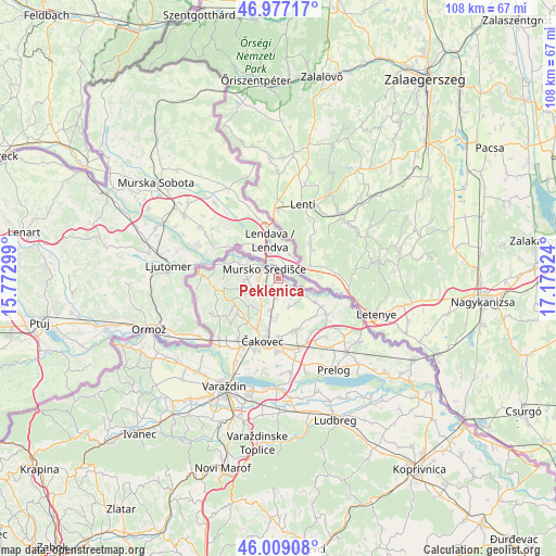
Peklenica GPS coordinates[2]
46° 29' 43.008" North, 16° 28' 33.996" East
| Map corner | latitude | longitude |
|---|---|---|
| Upper-left | 46.97717°, | 15.77299° |
| Center: | 46.49528°, | 16.47611° |
| Lower-right: | 46.00908°, | 17.17924° |
| Map W x H: | 107.6×107.6 km | = 66.9×66.9mi |
| max Lat: | 46.52694° ⇑0.4% North |
| Peklenica: | 46.49528° |
| min Lat: | ⇓99.6% South 42.54972° |
| min Long | Peklenica | max Long |
| 13.52389° | 16.47611° | 19.37694° |
| W 50.9%⇐ | ⇒49.1% E |
Elevation
Elevation of Peklenica is 183 m = 600 ft, and this is 29.7 m = 97 ft above average elevation for this country.
| Max E: |
827 m = 2713 ft | 23.8% |
| Peklenica | 183 m 600 ft | |
| Avg. | 153.3 m = 503 ft | |
Min E: |
-1 m = -3 ft | 76.2% |
See also: Croatia elevation on elevation.city.
Geographical zone
Peklenica is located in North temperate zone (between Tropic of Cancer and the Arctic Circle). Distance of this North polar circle is 2231.4 km =1386.5 mi to North.| Distance of | km | miles | from Peklenica |
|---|---|---|---|
| North Pole | 4837.3 | 3005.8 | to North |
| Arctic Circle | 2231.4 | 1386.5 | to North |
| Tropic Cancer | 2563.9 | 1593.1 | to South |
| Equator | 5169.8 | 3212.4 | to South |


Nearby cities:
15 places around Peklenica: (largest is in red/bold)
• Dekanovec
9.8 km =6.1 mi,  121°
121°
• Gornji Kraljevec
3.2 km =2 mi,  187°
187°
• Hlapičina
6.4 km =4 mi,  296°
296°
• Krištanovec
6 km =3.7 mi,  197°
197°
• Mačkovec
8.6 km =5.3 mi, 202°
• Mursko Središće
3.1 km =1.9 mi, 300°
• Novakovec
8.8 km =5.5 mi, 123°
• Novo Selo Rok
7.5 km =4.7 mi, 188°
• Podturen
6.2 km =3.9 mi, 123°
• Selnica
6.6 km =4.1 mi,  267°
267°
• Sivica
5.5 km =3.4 mi,  157°
157°
• Sveti Martin na Muri
8.5 km =5.3 mi,  294°
294°
• Vratišinec
2.4 km =1.5 mi,  216°
216°
• Zasadbreg
7 km =4.3 mi,  226°
226°
• Žiškovec
6 km =3.7 mi,  212°
212°
Sources, notices
• [Note1] Compared only with cities in Croatia existing in our database
• [Src1] Map data: © OpenStreetMap contributors (CC-BY-SA)
• [Src2] Other city data from geonames.org with taken over terms of usage.
• [Src3] Geographical zone / Annual Mean Temperature by Robert A. Rohde @ Wikipedia
