Nedelišće geodata
Nedelišće (Međimurska) is a seat of a second-order administrative division; located in Croatia in Europe/Zagreb (GMT+2) time zone. With population of 4,452 people, there are 89 cities with bigger population in this country. Compared to other cities in Croatia, 96.6% of cities are located further ↓South; 53.3% of cities are located further →East and 70.6% of cities have lower elevation than Nedelišće. Note1


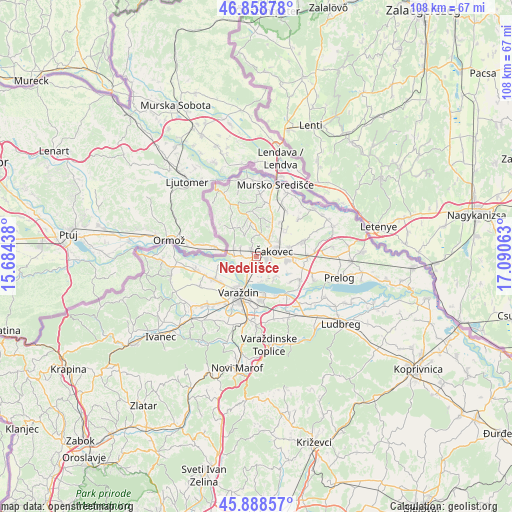
Nedelišće GPS coordinates[2]
46° 22' 32.988" North, 16° 23' 15" East
| Map corner | latitude | longitude |
|---|---|---|
| Upper-left | 46.85878°, | 15.68438° |
| Center: | 46.37583°, | 16.3875° |
| Lower-right: | 45.88857°, | 17.09063° |
| Map W x H: | 107.9×107.9 km | = 67×67mi |
| max Lat: | 46.52694° ⇑3.4% North |
| Nedelišće: | 46.37583° |
| min Lat: | ⇓96.6% South 42.54972° |
| min Long | Nedelišće | max Long |
| 13.52389° | 16.3875° | 19.37694° |
| W 46.7%⇐ | ⇒53.3% E |
Elevation
Elevation of Nedelišće is 168 m = 551 ft, and this is 14.7 m = 48 ft above average elevation for this country.
| Max E: |
827 m = 2713 ft | 29.4% |
| Nedelišće | 168 m 551 ft | |
| Avg. | 153.3 m = 503 ft | |
Min E: |
-1 m = -3 ft | 70.6% |
See also: Croatia elevation on elevation.city.
Geographical zone
Nedelišće is located in North temperate zone (between Tropic of Cancer and the Arctic Circle). Distance of this North polar circle is 2244.7 km =1394.8 mi to North.| Distance of | km | miles | from Nedelišće |
|---|---|---|---|
| North Pole | 4850.6 | 3014 | to North |
| Arctic Circle | 2244.7 | 1394.8 | to North |
| Tropic Cancer | 2550.6 | 1584.9 | to South |
| Equator | 5156.5 | 3204.1 | to South |


Nearby cities:
15 places around Nedelišće: (largest is in red/bold)
• Brezje
4.8 km =3 mi,  1°
1°
• Dunjkovec
1.9 km =1.2 mi,  325°
325°
• Gornji Hrašćan
3 km =1.9 mi,  274°
274°
• Ivanovec
6.9 km =4.3 mi,  96°
96°
• Kuršanec
5.2 km =3.2 mi,  167°
167°
• Lopatinec
6.4 km =4 mi,  357°
357°
• Macinec
5 km =3.1 mi,  293°
293°
• Mačkovec
6.4 km =4 mi,  33°
33°
• Mihovljan
5.9 km =3.7 mi,  51°
51°
• Novo Selo na Dravi
6.1 km =3.8 mi,  145°
145°
• Slakovec
3.4 km =2.1 mi,  346°
346°
• Strahoninec
2.2 km =1.4 mi,  110°
110°
• Totovec
5.8 km =3.6 mi,  133°
133°
• Čakovec
3.7 km =2.3 mi,  74°
74°
• Šenkovec
4.5 km =2.8 mi,  35°
35°
Sources, notices
• [Note1] Compared only with cities in Croatia existing in our database
• [Src1] Map data: © OpenStreetMap contributors (CC-BY-SA)
• [Src2] Other city data from geonames.org with taken over terms of usage.
• [Src3] Geographical zone / Annual Mean Temperature by Robert A. Rohde @ Wikipedia
