Kuršanec geodata
Kuršanec (Međimurska) is a populated place; located in Croatia in Europe/Zagreb (GMT+2) time zone. With population of 1,584 people, there are 275 cities with bigger population in this country. Compared to other cities in Croatia, 94.4% of cities are located further ↓South; 52.4% of cities are located further →East and 69% of cities have lower elevation than Kuršanec. Note1


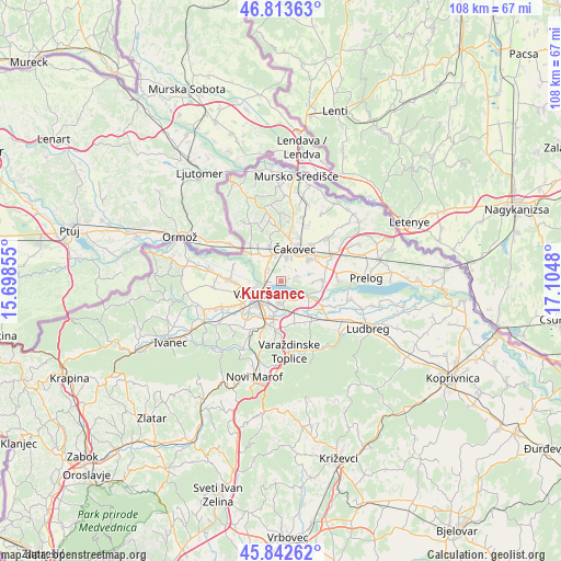
Kuršanec GPS coordinates[2]
46° 19' 49.008" North, 16° 24' 6.012" East
| Map corner | latitude | longitude |
|---|---|---|
| Upper-left | 46.81363°, | 15.69855° |
| Center: | 46.33028°, | 16.40167° |
| Lower-right: | 45.84262°, | 17.1048° |
| Map W x H: | 108×108 km | = 67.1×67.1mi |
| max Lat: | 46.52694° ⇑5.6% North |
| Kuršanec: | 46.33028° |
| min Lat: | ⇓94.4% South 42.54972° |
| min Long | Kuršanec | max Long |
| 13.52389° | 16.40167° | 19.37694° |
| W 47.6%⇐ | ⇒52.4% E |
Elevation
Elevation of Kuršanec is 165 m = 541 ft, and this is 11.7 m = 38 ft above average elevation for this country.
| Max E: |
827 m = 2713 ft | 31% |
| Kuršanec | 165 m 541 ft | |
| Avg. | 153.3 m = 503 ft | |
Min E: |
-1 m = -3 ft | 69% |
See also: Croatia elevation on elevation.city.
Geographical zone
Kuršanec is located in North temperate zone (between Tropic of Cancer and the Arctic Circle). Distance of this North polar circle is 2249.7 km =1397.9 mi to North.| Distance of | km | miles | from Kuršanec |
|---|---|---|---|
| North Pole | 4855.6 | 3017.1 | to North |
| Arctic Circle | 2249.7 | 1397.9 | to North |
| Tropic Cancer | 2545.5 | 1581.7 | to South |
| Equator | 5151.4 | 3200.9 | to South |


Nearby cities:
15 places around Kuršanec: (largest is in red/bold)
• Bartolovec
4.7 km =2.9 mi,  139°
139°
• Donji Kućan
5.6 km =3.5 mi,  186°
186°
• Dunjkovec
7 km =4.3 mi,  342°
342°
• Gornji Hrašćan
6.7 km =4.2 mi,  322°
322°
• Ivanovec
7.1 km =4.4 mi,  53°
53°
• Kućan Marof
5.1 km =3.2 mi,  206°
206°
• Nedelišće
5.2 km =3.2 mi,  347°
347°
• Novo Selo na Dravi
2.4 km =1.5 mi,  88°
88°
• Strahoninec
4.4 km =2.7 mi,  13°
13°
• Totovec
3.3 km =2.1 mi,  70°
70°
• Trnovec Bartolovečki
4 km =2.5 mi,  183°
183°
• Varaždin
5.7 km =3.5 mi,  239°
239°
• Zbelava
5.1 km =3.2 mi,  173°
173°
• Čakovec
6.5 km =4 mi,  22°
22°
• Šemovec
6 km =3.7 mi,  119°
119°
Sources, notices
• [Note1] Compared only with cities in Croatia existing in our database
• [Src1] Map data: © OpenStreetMap contributors (CC-BY-SA)
• [Src2] Other city data from geonames.org with taken over terms of usage.
• [Src3] Geographical zone / Annual Mean Temperature by Robert A. Rohde @ Wikipedia
