Ivanec geodata
Ivanec (Varaždinska) is a seat of a second-order administrative division; located in Croatia in Europe/Zagreb (GMT+2) time zone. With population of 5,461 people, there are 71 cities with bigger population in this country. Compared to other cities in Croatia, 89.4% of cities are located further ↓South; 64.4% of cities are located further →East and 83.9% of cities have lower elevation than Ivanec. Note1


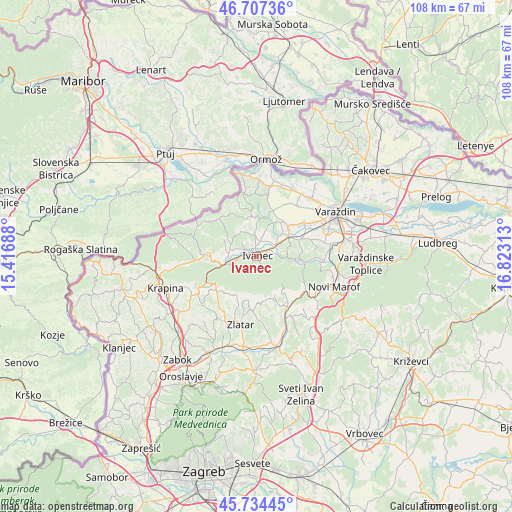
Ivanec GPS coordinates[2]
46° 13' 23.016" North, 16° 7' 12" East
| Map corner | latitude | longitude |
|---|---|---|
| Upper-left | 46.70736°, | 15.41688° |
| Center: | 46.22306°, | 16.12° |
| Lower-right: | 45.73445°, | 16.82313° |
| Map W x H: | 108.2×108.2 km | = 67.2×67.2mi |
| max Lat: | 46.52694° ⇑10.6% North |
| Ivanec: | 46.22306° |
| min Lat: | ⇓89.4% South 42.54972° |
| min Long | Ivanec | max Long |
| 13.52389° | 16.12° | 19.37694° |
| W 35.6%⇐ | ⇒64.4% E |
Elevation
Elevation of Ivanec is 230 m = 755 ft, and this is 76.7 m = 252 ft above average elevation for this country.
| Max E: |
827 m = 2713 ft | 16.1% |
| Ivanec | 230 m 755 ft | |
| Avg. | 153.3 m = 503 ft | |
Min E: |
-1 m = -3 ft | 83.9% |
See also: Croatia elevation on elevation.city.
Geographical zone
Ivanec is located in North temperate zone (between Tropic of Cancer and the Arctic Circle). Distance of this North polar circle is 2261.7 km =1405.4 mi to North.| Distance of | km | miles | from Ivanec |
|---|---|---|---|
| North Pole | 4867.5 | 3024.5 | to North |
| Arctic Circle | 2261.7 | 1405.4 | to North |
| Tropic Cancer | 2533.6 | 1574.3 | to South |
| Equator | 5139.5 | 3193.5 | to South |


Nearby cities:
15 places around Ivanec: (largest is in red/bold)
• Bedenec
4.2 km =2.6 mi,  297°
297°
• Donja Voća
8.7 km =5.4 mi,  352°
352°
• Donje Ladanje
9.3 km =5.8 mi,  22°
22°
• Gornje Ladanje
10.5 km =6.5 mi, 20°
• Jerovec
2 km =1.2 mi,  333°
333°
• Klenovnik
6.5 km =4 mi,  323°
323°
• Lepoglava
6.6 km =4.1 mi,  257°
257°
• Lobor
8.8 km =5.5 mi,  207°
207°
• Lobor
9.5 km =5.9 mi, 209°
• Maruševec
8.8 km =5.5 mi,  33°
33°
• Prigorec
2.8 km =1.7 mi,  160°
160°
• Salinovec
3.2 km =2 mi,  88°
88°
• Tužno
9.6 km =6 mi,  67°
67°
• Žarovnica
5.1 km =3.2 mi,  289°
289°
• Žarovnica
7.4 km =4.6 mi, 299°
Sources, notices
• [Note1] Compared only with cities in Croatia existing in our database
• [Src1] Map data: © OpenStreetMap contributors (CC-BY-SA)
• [Src2] Other city data from geonames.org with taken over terms of usage.
• [Src3] Geographical zone / Annual Mean Temperature by Robert A. Rohde @ Wikipedia
