Gerovo geodata
Gerovo (Primorsko-Goranska) is a populated place; located in Croatia in Europe/Zagreb (GMT+2) time zone. With population of 689 people, there are 674 cities with bigger population in this country. Compared to other cities in Croatia, 54.2% of cities are located further ↓South; 91.2% of cities are located further →East and 98.2% of cities have lower elevation than Gerovo. Note1


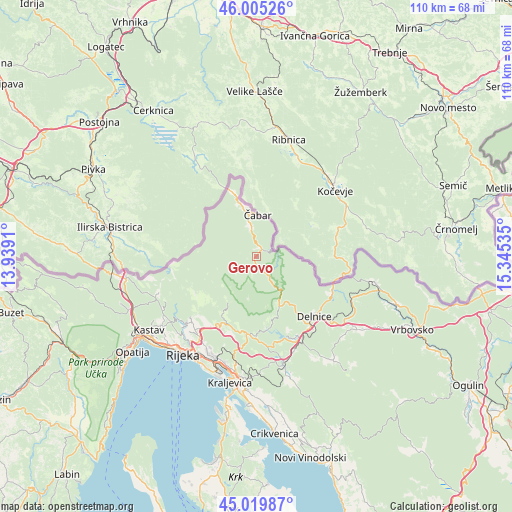
Gerovo GPS coordinates[2]
45° 30' 52.992" North, 14° 38' 31.992" East
| Map corner | latitude | longitude |
|---|---|---|
| Upper-left | 46.00526°, | 13.9391° |
| Center: | 45.51472°, | 14.64222° |
| Lower-right: | 45.01987°, | 15.34535° |
| Map W x H: | 109.6×109.6 km | = 68.1×68.1mi |
| max Lat: | 46.52694° ⇑45.8% North |
| Gerovo: | 45.51472° |
| min Lat: | ⇓54.2% South 42.54972° |
| min Long | Gerovo | max Long |
| 13.52389° | 14.64222° | 19.37694° |
| W 8.8%⇐ | ⇒91.2% E |
Elevation
Elevation of Gerovo is 570 m = 1870 ft, and this is 416.7 m = 1367 ft above average elevation for this country.
| Max E: |
827 m = 2713 ft | 1.8% |
| Gerovo | 570 m 1870 ft | |
| Avg. | 153.3 m = 503 ft | |
Min E: |
-1 m = -3 ft | 98.2% |
See also: Croatia elevation on elevation.city.
Geographical zone
Gerovo is located in North temperate zone (between Tropic of Cancer and the Arctic Circle). Distance of this North polar circle is 2340.4 km =1454.3 mi to North.| Distance of | km | miles | from Gerovo |
|---|---|---|---|
| North Pole | 4946.3 | 3073.5 | to North |
| Arctic Circle | 2340.4 | 1454.3 | to North |
| Tropic Cancer | 2454.8 | 1525.3 | to South |
| Equator | 5060.8 | 3144.6 | to South |


Nearby cities:
15 places around Gerovo: (largest is in red/bold)
• Buzdohanj
22.3 km =13.9 mi,  212°
212°
• Cernik
21.9 km =13.6 mi, 209°
• Delnice
17.6 km =10.9 mi,  135°
135°
• Dražice
19.2 km =11.9 mi,  224°
224°
• Jelenje
20.7 km =12.9 mi,  226°
226°
• Klana
22 km =13.7 mi,  249°
249°
• Krasica
23.8 km =14.8 mi,  196°
196°
• Kukuljanovo
22.5 km =14 mi, 200°
• Lokve
19.2 km =11.9 mi,  154°
154°
• Marčelji
23.7 km =14.7 mi,  236°
236°
• Podhum
19 km =11.8 mi, 221°
• Prezid
14.5 km =9 mi,  339°
339°
• Skrad
23.1 km =14.4 mi,  114°
114°
• Čavle
21.9 km =13.6 mi, 214°
• Škrljevo
23.2 km =14.4 mi, 201°
Sources, notices
• [Note1] Compared only with cities in Croatia existing in our database
• [Src1] Map data: © OpenStreetMap contributors (CC-BY-SA)
• [Src2] Other city data from geonames.org with taken over terms of usage.
• [Src3] Geographical zone / Annual Mean Temperature by Robert A. Rohde @ Wikipedia
