Garešnica geodata
Garešnica (Bjelovarsko-Bilogorska) is a seat of a second-order administrative division; located in Croatia in Europe/Zagreb (GMT+2) time zone. With population of 4,273 people, there are 96 cities with bigger population in this country. Compared to other cities in Croatia, 57.2% of cities are located further ↓South; 66.9% of cities are located further ←West and 54.4% of cities have higher elevation than Garešnica. Note1


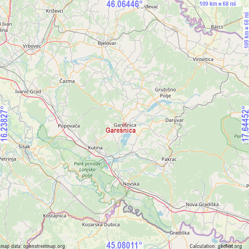
Garešnica GPS coordinates[2]
45° 34' 27.984" North, 16° 56' 29.004" East
| Map corner | latitude | longitude |
|---|---|---|
| Upper-left | 46.06446°, | 16.23827° |
| Center: | 45.57444°, | 16.94139° |
| Lower-right: | 45.08011°, | 17.64452° |
| Map W x H: | 109.4×109.4 km | = 68×68mi |
| max Lat: | 46.52694° ⇑42.8% North |
| Garešnica: | 45.57444° |
| min Lat: | ⇓57.2% South 42.54972° |
| min Long | Garešnica | max Long |
| 13.52389° | 16.94139° | 19.37694° |
| W 66.9%⇐ | ⇒33.1% E |
Elevation
Elevation of Garešnica is 118 m = 387 ft, and this is 35.3 m = 116 ft below average elevation for this country.
| Max E: |
827 m = 2713 ft | 54.4% |
| Avg. | 153.3 m = 503 ft | |
| Garešnica | 118 m = 387 ft | |
Min E: |
-1 m = -3 ft | 45.6% |
See also: Croatia elevation on elevation.city.
Geographical zone
Garešnica is located in North temperate zone (between Tropic of Cancer and the Arctic Circle). Distance of this North polar circle is 2333.8 km =1450.2 mi to North.| Distance of | km | miles | from Garešnica |
|---|---|---|---|
| North Pole | 4939.7 | 3069.4 | to North |
| Arctic Circle | 2333.8 | 1450.2 | to North |
| Tropic Cancer | 2461.5 | 1529.5 | to South |
| Equator | 5067.4 | 3148.7 | to South |


Nearby cities:
15 places around Garešnica: (largest is in red/bold)
• Banova Jaruga
15 km =9.3 mi,  190°
190°
• Dežanovac
11.3 km =7 mi,  92°
92°
• Gornja Jelenska
19 km =11.8 mi,  278°
278°
• Hercegovac
10.9 km =6.8 mi,  30°
30°
• Husain
15 km =9.3 mi,  221°
221°
• Ilova
14.7 km =9.1 mi,  201°
201°
• Kapelica
3.7 km =2.3 mi,  271°
271°
• Končanica
18.8 km =11.7 mi,  68°
68°
• Kutina
16.6 km =10.3 mi,  228°
228°
• Kutinska Slatina
13.9 km =8.6 mi,  242°
242°
• Palešnik
7.4 km =4.6 mi,  21°
21°
• Poljana
12 km =7.5 mi,  165°
165°
• Repušnica
18.7 km =11.6 mi, 241°
• Velika Trnovitica
12.1 km =7.5 mi,  4°
4°
• Veliki Zdenci
17.1 km =10.6 mi,  49°
49°
Sources, notices
• [Note1] Compared only with cities in Croatia existing in our database
• [Src1] Map data: © OpenStreetMap contributors (CC-BY-SA)
• [Src2] Other city data from geonames.org with taken over terms of usage.
• [Src3] Geographical zone / Annual Mean Temperature by Robert A. Rohde @ Wikipedia
