Husain geodata
Husain (Sisačko-Moslavačka) is a populated place; located in Croatia in Europe/Zagreb (GMT+2) time zone. With population of 971 people, there are 471 cities with bigger population in this country. Compared to other cities in Croatia, 52% of cities are located further ↓South; 63.4% of cities are located further ←West and 52.9% of cities have lower elevation than Husain. Note1


Husain GPS coordinates[2]
45° 28' 27.012" North, 16° 48' 47.016" East
| Map corner | latitude | longitude |
|---|---|---|
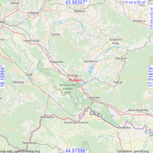
| Upper-left | 45.96507°, | 16.10994° |
| Center: | 45.47417°, | 16.81306° |
| Lower-right: | 44.97896°, | 17.51619° |
| Map W x H: | 109.6×109.6 km | = 68.1×68.1mi |
| max Lat: | 46.52694° ⇑48% North |
| Husain: | 45.47417° |
| min Lat: | ⇓52% South 42.54972° |
| min Long | Husain | max Long |
| 13.52389° | 16.81306° | 19.37694° |
| W 63.4%⇐ | ⇒36.6% E |
Elevation
Elevation of Husain is 132 m = 433 ft, and this is 21.3 m = 70 ft below average elevation for this country.
| Max E: |
827 m = 2713 ft | 47.1% |
| Avg. | 153.3 m = 503 ft | |
| Husain | 132 m = 433 ft | |
Min E: |
-1 m = -3 ft | 52.9% |
See also: Croatia elevation on elevation.city.
Geographical zone
Husain is located in North temperate zone (between Tropic of Cancer and the Arctic Circle). Distance of this North polar circle is 2344.9 km =1457.1 mi to North.| Distance of | km | miles | from Husain |
|---|---|---|---|
| North Pole | 4950.8 | 3076.3 | to North |
| Arctic Circle | 2344.9 | 1457.1 | to North |
| Tropic Cancer | 2450.3 | 1522.5 | to South |
| Equator | 5056.3 | 3141.8 | to South |


Nearby cities:
15 places around Husain: (largest is in red/bold)
• Banova Jaruga
8 km =5 mi,  116°
116°
• Donja Gračenica
10.7 km =6.6 mi,  282°
282°
• Garešnica
15 km =9.3 mi,  41°
41°
• Gornja Gračenica
10.1 km =6.3 mi,  295°
295°
• Ilova
5.3 km =3.3 mi, 118°
• Kapelica
12.9 km =8 mi,  29°
29°
• Kutina
2.4 km =1.5 mi,  272°
272°
• Kutinska Slatina
5.3 km =3.3 mi,  333°
333°
• Lipovljani
10.5 km =6.5 mi,  145°
145°
• Nova Subocka
14.1 km =8.8 mi,  143°
143°
• Osekovo
16 km =9.9 mi,  287°
287°
• Poljana
13.1 km =8.1 mi,  92°
92°
• Repušnica
6.7 km =4.2 mi, 287°
• Stara Subocka
14.8 km =9.2 mi, 153°
• Voloder
13.3 km =8.3 mi,  308°
308°
Sources, notices
• [Note1] Compared only with cities in Croatia existing in our database
• [Src1] Map data: © OpenStreetMap contributors (CC-BY-SA)
• [Src2] Other city data from geonames.org with taken over terms of usage.
• [Src3] Geographical zone / Annual Mean Temperature by Robert A. Rohde @ Wikipedia
